Distance Between Brazil Cities
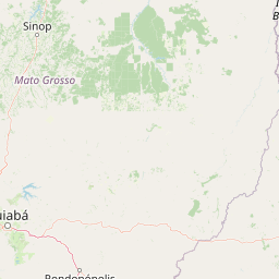
Distance from Brazil to major cities are listed below, or choose from the list to calculate distance. 27 major city distances are calculated in Brazil country. The GPS coordinates of Brazil is 14° 14´ 6.0144'' S and 51° 55´ 31.0152'' W. Some of the leading cities of Brazil are Sao Paulo, Rio de Janeiro, Salvador.


Leaflet | © OpenStreetMap
Distances of Brazil Cities
List of Brazil cities with distance in kilometers.
Visit city distance page to calculate distance to all cities.
| City | Distance |
|---|---|
| Sao Paulo to Rio de Janeiro | 358 km |
| Salvador to Fortaleza | 1029 km |
| Belo Horizonte to Brasilia | 625 km |
| Curitiba to Manaus | 2736 km |
| Recife to Belem | 1678 km |
| Porto Alegre to Goiania | 1498 km |
| Maceio to Sao Luis | 1235 km |
| Natal to Teresina | 844 km |
| Campo Grande to Joao Pessoa | 2595 km |
| Cuiaba to Aracaju | 2123 km |
| Florianopolis to Macapa | 3085 km |
| Vitoria to Porto Velho | 2838 km |
| Rio Branco to Boa Vista | 1627 km |
| Palmas |
The Nearest Neighboring Countries to Brazil
Distance from Brazil to the nearest countries.
The distance between Brazil and the nearest country Paraguay is 1232 km.
| Country | Distance to Brazil |
|---|---|
| Paraguay | 1232 km |
| Bolivia | 1272 km |
| French Guiana | 2025 km |
| Suriname | 2069 km |
| Uruguay | 2070 km |
| Guyana | 2260 km |
| Peru | 2574 km |
| Venezuela | 2810 km |
| Argentina | 2924 km |
Click on the city name to list the sub cities within the major city, and calculate the distance between cities.