Distance Between Bulgaria Cities
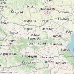
Distance from Bulgaria to major cities are listed below, or choose from the list to calculate distance. 27 major city distances are calculated in Bulgaria country. The GPS coordinates of Bulgaria is 42° 44´ 1.9788'' N and 25° 29´ 8.9880'' E. Some of the leading cities of Bulgaria are Sofia, Plovdiv, Varna.


Leaflet | © OpenStreetMap
Distances of Bulgaria Cities
List of Bulgaria cities with distance in kilometers.
Visit city distance page to calculate distance to all cities.
| City | Distance |
|---|---|
| Sofia to Plovdiv | 132 km |
| Varna to Burgas | 87 km |
| Ruse to Stara Zagora | 161 km |
| Pleven to Sliven | 161 km |
| Dobrich to Shumen | 81 km |
| Pernik to Yambol | 284 km |
| Haskovo to Pazardzhik | 105 km |
| Blagoevgrad to Veliko Turnovo | 239 km |
| Gabrovo to Vratsa | 149 km |
| Vidin to Kurdzhali | 330 km |
| Kyustendil to Montana | 133 km |
| Lovech to Silistra | 233 km |
| Razgrad to Targovishte | 32 km |
| Smolyan |
The Nearest Neighboring Countries to Bulgaria
Distance from Bulgaria to the nearest countries.
The distance between Bulgaria and the nearest country Macedonia is 333 km.
| Country | Distance to Bulgaria |
|---|---|
| Macedonia | 333 km |
| Romania | 359 km |
| Kosovo | 375 km |
| Serbia | 389 km |
| Albania | 474 km |
| Montenegro | 499 km |
| Greece | 510 km |
| Moldova | 567 km |
| Bosnia and Herzegovina | 645 km |
Click on the city name to list the sub cities within the major city, and calculate the distance between cities.