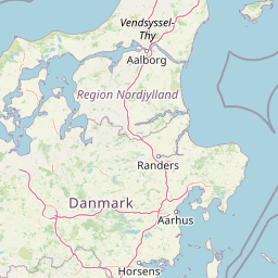
Distance Between Denmark Cities
Distance from Denmark to major cities are listed below, or choose from the list to calculate distance. 5 major city distances are calculated in Denmark country. The GPS coordinates of Denmark is 56° 15´ 50.1120'' N and 9° 30´ 6.4260'' E. Some of the leading cities of Denmark are Copenhagen, Aalborg, Vejle.


Leaflet | © OpenStreetMap
Distances of Denmark Cities
List of Denmark cities with distance in kilometers.
Visit city distance page to calculate distance to all cities.
| City | Distance |
|---|---|
| Copenhagen to Aalborg | 223 km |
| Vejle to Viborg | 83 km |
| Hillerod |
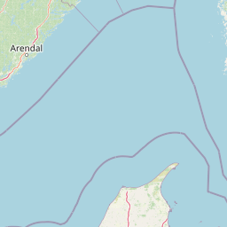
The Nearest Neighboring Countries to Denmark
Distance from Denmark to the nearest countries.
The distance between Denmark and the nearest country Norway is 472 km.
| Country | Distance to Denmark |
|---|---|
| Norway | 472 km |
| Netherlands | 535 km |
| Germany | 570 km |
| Sweden | 686 km |
| Belgium | 722 km |
| Aland Islands | 748 km |
| Luxembourg | 751 km |
| Poland | 792 km |
| United Kingdom | 813 km |
Click on the city name to list the sub cities within the major city, and calculate the distance between cities.