Distance Between Guatemala Cities
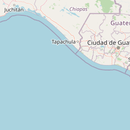
Distance from Guatemala to major cities are listed below, or choose from the list to calculate distance. 21 major city distances are calculated in Guatemala country. The GPS coordinates of Guatemala is 15° 47´ 0.4956'' N and 90° 13´ 50.7324'' W. Some of the leading cities of Guatemala are Guatemala City, Quetzaltenango, Escuintla.


Leaflet | © OpenStreetMap
Distances of Guatemala Cities
List of Guatemala cities with distance in kilometers.
Visit city distance page to calculate distance to all cities.
| City | Distance |
|---|---|
| Guatemala City to Quetzaltenango | 110 km |
| Escuintla to Chimaltenango | 40 km |
| Huehuetenango to Totonicapan | 47 km |
| Puerto Barrios to Coban | 192 km |
| Jalapa to Solola | 129 km |
| Mazatenango to Chiquimula | 213 km |
| Salama to Antigua Guatemala | 75 km |
| Retalhuleu to Zacapa | 236 km |
| Jutiapa to San Marcos | 218 km |
| Santa Cruz del Quiche to Flores | 249 km |
| Cuilapa |
The Nearest Neighboring Countries to Guatemala
Distance from Guatemala to the nearest countries.
The distance between Guatemala and the nearest country Belize is 242 km.
| Country | Distance to Guatemala |
|---|---|
| Belize | 242 km |
| El Salvador | 264 km |
| Honduras | 432 km |
| Nicaragua | 631 km |
| Costa Rica | 971 km |
Click on the city name to list the sub cities within the major city, and calculate the distance between cities.