Distance Between Haiti Cities
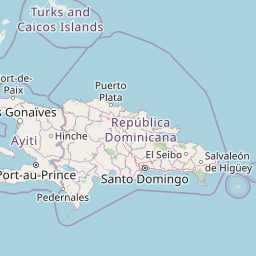
Distance from Haiti to major cities are listed below, or choose from the list to calculate distance. 9 major city distances are calculated in Haiti country. The GPS coordinates of Haiti is 18° 58´ 16.2768'' N and 72° 17´ 6.7812'' W. Some of the leading cities of Haiti are Port-au-Prince, Port-de-Paix, Jacmel.


Leaflet | © OpenStreetMap
Distances of Haiti Cities
List of Haiti cities with distance in kilometers.
Visit city distance page to calculate distance to all cities.
| City | Distance |
|---|---|
| Port-au-Prince to Port-de-Paix | 164 km |
| Jacmel to Okap | 173 km |
| Les Cayes to Jeremie | 64 km |
| Miragoane to Gonayiv | 119 km |
| Hinche |
The Nearest Neighboring Countries to Haiti
Distance from Haiti to the nearest countries.
The distance between Haiti and the nearest country Dominican Republic is 225 km.
| Country | Distance to Haiti |
|---|---|
| Dominican Republic | 225 km |
| Turks and Caicos Islands | 307 km |
| Jamaica | 537 km |
| Puerto Rico | 606 km |
| Cuba | 640 km |
| Aruba | 759 km |
| U.S. Virgin Islands | 782 km |
| British Virgin Islands | 808 km |
| Curacao | 835 km |
Click on the city name to list the sub cities within the major city, and calculate the distance between cities.