Distance Between Jamaica Cities
Distance from Jamaica to major cities are listed below, or choose from the list to calculate distance. 7 major city distances are calculated in Jamaica country. The GPS coordinates of Jamaica is 18° 6´ 34.4916'' N and 77° 17´ 51.0288'' W. Some of the leading cities of Jamaica are Kingston, Spanish Town, Montego Bay.


Leaflet | © OpenStreetMap
Distances of Jamaica Cities
List of Jamaica cities with distance in kilometers.
Visit city distance page to calculate distance to all cities.
| City | Distance |
|---|---|
| Kingston to Spanish Town | 17 km |
| Montego Bay to Mandeville | 65 km |
| May Pen to Half Way Tree | 47 km |
| Savanna-la-Mar |
The Nearest Neighboring Countries to Jamaica
Distance from Jamaica to the nearest countries.
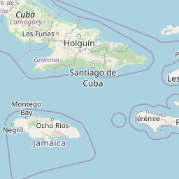
The distance between Jamaica and the nearest country Cuba is 383 km.
| Country | Distance to Jamaica |
|---|---|
| Cuba | 383 km |
| Cayman Islands | 438 km |
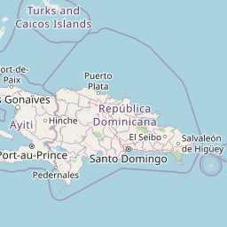
| Haiti | 537 km |
| Turks and Caicos Islands | 700 km |
| Dominican Republic | 756 km |
| Bahamas | 770 km |
Click on the city name to list the sub cities within the major city, and calculate the distance between cities.