Distance Between Nicaragua Cities
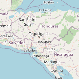
Distance from Nicaragua to major cities are listed below, or choose from the list to calculate distance. 16 major city distances are calculated in Nicaragua country. The GPS coordinates of Nicaragua is 12° 51´ 55.4976'' N and 85° 12´ 26.0280'' W. Some of the leading cities of Nicaragua are Managua, Leon, Masaya.


Leaflet | © OpenStreetMap
Distances of Nicaragua Cities
List of Nicaragua cities with distance in kilometers.
Visit city distance page to calculate distance to all cities.
| City | Distance |
|---|---|
| Managua to Leon | 76 km |
| Masaya to Chinandega | 134 km |
| Matagalpa to Esteli | 51 km |
| Granada to Juigalpa | 67 km |
| Jinotega to Bluefields | 271 km |
| Ocotal to Puerto Cabezas | 336 km |
| Rivas to Jinotepe | 61 km |
| Boaco to Somoto | 150 km |
The Nearest Neighboring Countries to Nicaragua
Distance from Nicaragua to the nearest countries.
The distance between Nicaragua and the nearest country Honduras is 283 km.
| Country | Distance to Nicaragua |
|---|---|
| Honduras | 283 km |
| Costa Rica | 381 km |
| El Salvador | 412 km |
| Belize | 597 km |
| Guatemala | 631 km |
| Panama | 682 km |
| Cayman Islands | 832 km |
Click on the city name to list the sub cities within the major city, and calculate the distance between cities.