Distance Between Norway Cities
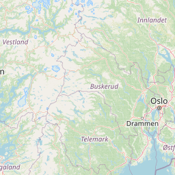
Distance from Norway to major cities are listed below, or choose from the list to calculate distance. 16 major city distances are calculated in Norway country. The GPS coordinates of Norway is 60° 28´ 19.2828'' N and 8° 28´ 8.2056'' E. Some of the leading cities of Norway are Oslo, Bergen, Trondheim.


Leaflet | © OpenStreetMap
Distances of Norway Cities
List of Norway cities with distance in kilometers.
Visit city distance page to calculate distance to all cities.
| City | Distance |
|---|---|
| Oslo to Bergen | 305 km |
| Trondheim to Stavanger | 555 km |
| Drammen to Kristiansand | 218 km |
| Tromso to Skien | 1241 km |
| Tonsberg to Moss | 23 km |
| Bodo to Arendal | 1020 km |
| Hamar to Steinkjer | 359 km |
| Lillehammer to Molde | 250 km |
The Nearest Neighboring Countries to Norway
Distance from Norway to the nearest countries.
The distance between Norway and the nearest country Denmark is 472 km.
| Country | Distance to Norway |
|---|---|
| Denmark | 472 km |
| Sweden | 561 km |
| Aland Islands | 630 km |
| Faroe Islands | 837 km |
| United Kingdom | 900 km |
| Finland | 937 km |
| Netherlands | 948 km |
| Estonia | 953 km |
Click on the city name to list the sub cities within the major city, and calculate the distance between cities.