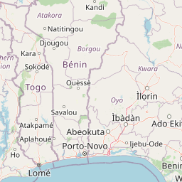
Distance Between Togo Cities
Distance from Togo to major cities are listed below, or choose from the list to calculate distance. 5 major city distances are calculated in Togo country. The GPS coordinates of Togo is 8° 37´ 10.3548'' N and 0° 49´ 29.2152'' E. Some of the leading cities of Togo are Lome, Sokode, Kara.


Leaflet | © OpenStreetMap
Distances of Togo Cities
List of Togo cities with distance in kilometers.
Visit city distance page to calculate distance to all cities.
| City | Distance |
|---|---|
| Lome to Sokode | 317 km |
| Kara to Atakpame | 224 km |
| Dapaong |
The Nearest Neighboring Countries to Togo
Distance from Togo to the nearest countries.
The distance between Togo and the nearest country Benin is 181 km.
| Country | Distance to Togo |
|---|---|
| Benin | 181 km |
| Ghana | 217 km |
| Burkina Faso | 480 km |
| Ivory Coast | 712 km |
| Nigeria | 864 km |
Click on the city name to list the sub cities within the major city, and calculate the distance between cities.