Distance from Gulu to Kitgum
Distance between Gulu and Kitgum is 86 kilometers (53 miles).
Driving distance from Gulu to Kitgum is 102 kilometers (63 miles).
Distance Map Between Gulu and Kitgum
Gulu, Gulu, Uganda ↔ Kitgum, Gulu, Uganda = 53 miles = 86 km.

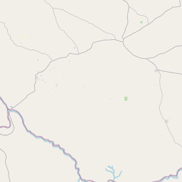


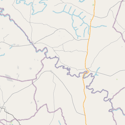
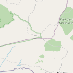


Leaflet | © OpenStreetMap
How far is it between Gulu and Kitgum
Gulu is located in Uganda with (2.7746,32.299) coordinates and Kitgum is located in Uganda with (3.2783,32.8867) coordinates. The calculated flying distance from Gulu to Kitgum is equal to 53 miles which is equal to 86 km.
If you want to go by car, the driving distance between Gulu and Kitgum is 102.04 km. If you ride your car with an average speed of 112 kilometers/hour (70 miles/h), travel time will be 00 hours 54 minutes. Please check the avg. speed travel time table on the right for various options.
Difference between fly and go by a car is 16 km.
| City/Place | Latitude and Longitude | GPS Coordinates |
|---|---|---|
| Gulu | 2.7746, 32.299 | 2° 46´ 28.4520'' N 32° 17´ 56.3640'' E |
| Kitgum | 3.2783, 32.8867 | 3° 16´ 41.9880'' N 32° 53´ 12.0120'' E |
Estimated Travel Time Between Gulu and Kitgum
| Average Speed | Travel Time |
|---|---|
| 30 mph (48 km/h) | 02 hours 07 minutes |
| 40 mph (64 km/h) | 01 hours 35 minutes |
| 50 mph (80 km/h) | 01 hours 16 minutes |
| 60 mph (97 km/h) | 01 hours 03 minutes |
| 70 mph (112 km/h) | 00 hours 54 minutes |
| 75 mph (120 km/h) | 00 hours 51 minutes |
Gulu, Gulu, Uganda
Related Distances from Gulu
| Cities | Distance |
|---|---|
| Gulu to Kampala | 334 km |
| Gulu to Kitgum | 102 km |
| Gulu to Arua | 250 km |
| Gulu to Jinja | 385 km |
| Gulu to Mbarara | 538 km |
Kitgum, Gulu, Uganda
Related Distances to Kitgum
| Cities | Distance |
|---|---|
| Kampala to Kitgum | 439 km |
| Gulu to Kitgum | 102 km |
| Arua to Kitgum | 339 km |
| Adjumani to Kitgum | 158 km |