Distance from Abobo to Ketou
Distance between Abobo and Ketou is 762 kilometers (474 miles).
Driving distance from Abobo to Ketou is 986 kilometers (613 miles).
Distance Map Between Abobo and Ketou
Abobo, Abidjan, Ivory Coast ↔ Ketou, Sakete, Benin = 474 miles = 762 km.


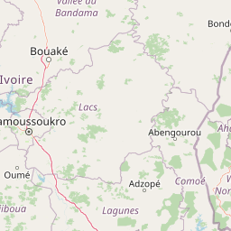


How far is it between Abobo and Kétou
Abobo is located in Ivory Coast with (5.4161,-4.0159) coordinates and Ketou is located in Benin with (7.3633,2.5998) coordinates. The calculated flying distance from Abobo to Ketou is equal to 474 miles which is equal to 762 km.
If you want to go by car, the driving distance between Abobo and Ketou is 986.34 km. If you ride your car with an average speed of 112 kilometers/hour (70 miles/h), travel time will be 08 hours 48 minutes. Please check the avg. speed travel time table on the right for various options.
Difference between fly and go by a car is 224 km.
| City/Place | Latitude and Longitude | GPS Coordinates |
|---|---|---|
| Abobo | 5.4161, -4.0159 | 5° 24´ 58.0680'' N 4° 0´ 57.2400'' W |
| Ketou | 7.3633, 2.5998 | 7° 21´ 47.9520'' N 2° 35´ 59.2080'' E |
Estimated Travel Time Between Abobo and Kétou
| Average Speed | Travel Time |
|---|---|
| 30 mph (48 km/h) | 20 hours 32 minutes |
| 40 mph (64 km/h) | 15 hours 24 minutes |
| 50 mph (80 km/h) | 12 hours 19 minutes |
| 60 mph (97 km/h) | 10 hours 10 minutes |
| 70 mph (112 km/h) | 08 hours 48 minutes |
| 75 mph (120 km/h) | 08 hours 13 minutes |
Related Distances from Abobo
| Cities | Distance |
|---|---|
| Abobo to Porto Novo | 908 km |
| Abobo to Kandi | 1295 km |
| Abobo to Sakete | 937 km |
| Abobo to Tchaourou | 1161 km |
| Abobo to Banikoara | 1226 km |
Related Distances to Ketou
| Cities | Distance |
|---|---|
| Abidjan to Ketou | 983 km |
| Abobo to Ketou | 986 km |