Distance from Ahvaz to Ilam
Distance between Ahvaz and Ilam is 334 kilometers (207 miles).
Driving distance from Ahvaz to Ilam is 453 kilometers (282 miles).
Distance Map Between Ahvaz and Ilam
Ahvaz, Iran ↔ Ilam, Iran = 207 miles = 334 km.
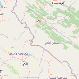


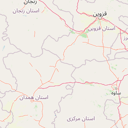


Leaflet | © OpenStreetMap
How far is it between Ahvaz and Īlām
Ahvaz is located in Iran with (31.319,48.6842) coordinates and Ilam is located in Iran with (33.6374,46.4227) coordinates. The calculated flying distance from Ahvaz to Ilam is equal to 207 miles which is equal to 334 km.
If you want to go by car, the driving distance between Ahvaz and Ilam is 453.1 km. If you ride your car with an average speed of 112 kilometers/hour (70 miles/h), travel time will be 04 hours 02 minutes. Please check the avg. speed travel time table on the right for various options.
Difference between fly and go by a car is 119 km.
| City/Place | Latitude and Longitude | GPS Coordinates |
|---|---|---|
| Ahvaz | 31.319, 48.6842 | 31° 19´ 8.4360'' N 48° 41´ 3.1200'' E |
| Ilam | 33.6374, 46.4227 | 33° 38´ 14.6400'' N 46° 25´ 21.7200'' E |
Estimated Travel Time Between Ahvaz and Īlām
| Average Speed | Travel Time |
|---|---|
| 30 mph (48 km/h) | 09 hours 26 minutes |
| 40 mph (64 km/h) | 07 hours 04 minutes |
| 50 mph (80 km/h) | 05 hours 39 minutes |
| 60 mph (97 km/h) | 04 hours 40 minutes |
| 70 mph (112 km/h) | 04 hours 02 minutes |
| 75 mph (120 km/h) | 03 hours 46 minutes |
Ahvaz, Iran
Related Distances from Ahvaz
| Cities | Distance |
|---|---|
| Ahvaz to Tehran | 818 km |
| Ahvaz to Shiraz | 529 km |
| Ahvaz to Bandar Abbas | 1107 km |
| Ahvaz to Kermanshah | 475 km |
| Ahvaz to Mashhad | 1635 km |
Ilam, Iran
Related Distances to Ilam
| Cities | Distance |
|---|---|
| Ahvaz to Ilam | 453 km |
| Isfahan to Ilam | 640 km |
| Zahedan to Ilam | 1833 km |
| Arak to Ilam | 458 km |
| Ardabil to Ilam | 848 km |