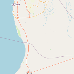
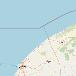
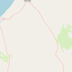
Distance from Ajdabiya to Benghazi
Distance between Ajdabiya and Benghazi is 152 kilometers (94 miles).
Driving distance from Ajdabiya to Benghazi is 162 kilometers (100 miles).
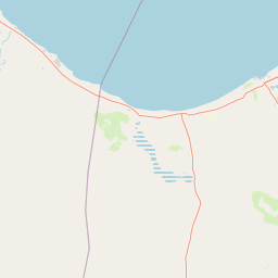
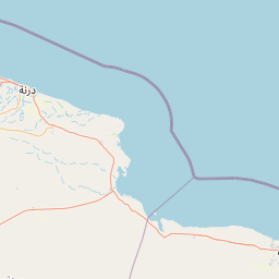
Distance Map Between Ajdabiya and Benghazi
Ajdabiya, Libya ↔ Benghazi, Libya = 94 miles = 152 km.


How far is it between Ajdabiya and Benghazi
Ajdabiya is located in Libya with (30.7555,20.2263) coordinates and Benghazi is located in Libya with (32.1149,20.0686) coordinates. The calculated flying distance from Ajdabiya to Benghazi is equal to 94 miles which is equal to 152 km.
If you want to go by car, the driving distance between Ajdabiya and Benghazi is 161.61 km. If you ride your car with an average speed of 112 kilometers/hour (70 miles/h), travel time will be 01 hours 26 minutes. Please check the avg. speed travel time table on the right for various options.
Difference between fly and go by a car is 10 km.
| City/Place | Latitude and Longitude | GPS Coordinates |
|---|---|---|
| Ajdabiya | 30.7555, 20.2263 | 30° 45´ 19.6200'' N 20° 13´ 34.5000'' E |
| Benghazi | 32.1149, 20.0686 | 32° 6´ 53.4960'' N 20° 4´ 6.9240'' E |
Estimated Travel Time Between Ajdabiya and Benghazi
| Average Speed | Travel Time |
|---|---|
| 30 mph (48 km/h) | 03 hours 22 minutes |
| 40 mph (64 km/h) | 02 hours 31 minutes |
| 50 mph (80 km/h) | 02 hours 01 minutes |
| 60 mph (97 km/h) | 01 hours 39 minutes |
| 70 mph (112 km/h) | 01 hours 26 minutes |
| 75 mph (120 km/h) | 01 hours 20 minutes |
Related Distances from Ajdabiya
| Cities | Distance |
|---|---|
| Ajdabiya to Al Bayda | 358 km |
| Ajdabiya to Al Marj | 253 km |
| Ajdabiya to Al Qubbah | 407 km |
| Ajdabiya to Az Zuwaytinah | 28 km |
| Ajdabiya to Benghazi | 162 km |
| Ajdabiya to Darnah | 448 km |
| Ajdabiya to Suluq | 109 km |
| Ajdabiya to Tobruk | 400 km |
Related Distances to Benghazi
| Cities | Distance |
|---|---|
| Al Marj to Benghazi | 95 km |
| Tripoli to Benghazi | 998 km |
| Ajdabiya to Benghazi | 162 km |
| Sirte to Benghazi | 570 km |
| Tobruk to Benghazi | 462 km |
| Al Bayda to Benghazi | 199 km |
| Sabha to Benghazi | 1159 km |
| Al Khums to Benghazi | 887 km |
| Hun to Benghazi | 813 km |
| Misratah to Benghazi | 833 km |