Distance from Al Jawf to Cairo
Distance between Al Jawf and Cairo is 1022 kilometers (635 miles).
Driving distance from Al Jawf to Cairo is 2044 kilometers (1270 miles).
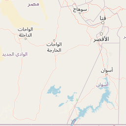
Distance Map Between Al Jawf and Cairo
Al Jawf, , Libya ↔ Cairo, Egypt = 635 miles = 1022 km.


How far is it between Al Jawf and Cairo
Al Jawf is located in Libya with (24.1989,23.2909) coordinates and Cairo is located in Egypt with (30.0626,31.2497) coordinates. The calculated flying distance from Al Jawf to Cairo is equal to 635 miles which is equal to 1022 km.
If you want to go by car, the driving distance between Al Jawf and Cairo is 2044.23 km. If you ride your car with an average speed of 112 kilometers/hour (70 miles/h), travel time will be 18 hours 15 minutes. Please check the avg. speed travel time table on the right for various options.
Difference between fly and go by a car is 1022 km.
| City/Place | Latitude and Longitude | GPS Coordinates |
|---|---|---|
| Al Jawf | 24.1989, 23.2909 | 24° 11´ 56.0400'' N 23° 17´ 27.3480'' E |
| Cairo | 30.0626, 31.2497 | 30° 3´ 45.4680'' N 31° 14´ 58.8120'' E |
Estimated Travel Time Between Al Jawf and Cairo
| Average Speed | Travel Time |
|---|---|
| 30 mph (48 km/h) | 42 hours 35 minutes |
| 40 mph (64 km/h) | 31 hours 56 minutes |
| 50 mph (80 km/h) | 25 hours 33 minutes |
| 60 mph (97 km/h) | 21 hours 04 minutes |
| 70 mph (112 km/h) | 18 hours 15 minutes |
| 75 mph (120 km/h) | 17 hours 02 minutes |
Related Distances from Al Jawf
| Cities | Distance |
|---|---|
| Al Jawf to Cairo | 2044 km |
| Al Jawf to Alexandria | 1897 km |
Related Distances to Cairo
| Cities | Distance |
|---|---|
| Tripoli to Cairo | 2027 km |
| Benghazi to Cairo | 1285 km |
| Tobruk to Cairo | 823 km |
| Sirte to Cairo | 1602 km |
| Ajdabiya to Cairo | 1191 km |