Distance from Alaminos to Batangas
Distance between Alaminos and Batangas is 40 kilometers (25 miles).
Driving distance from Alaminos to Batangas is 52 kilometers (32 miles).
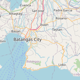
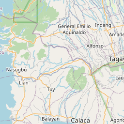
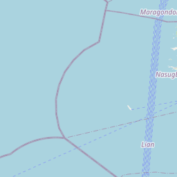
Distance Map Between Alaminos and Batangas
Alaminos, Calamba, Philippines ↔ Batangas, Calamba, Philippines = 25 miles = 40 km.


How far is it between Alaminos and Batangas
Alaminos is located in Philippines with (14.0639,121.2465) coordinates and Batangas is located in Philippines with (13.7567,121.0584) coordinates. The calculated flying distance from Alaminos to Batangas is equal to 25 miles which is equal to 40 km.
If you want to go by car, the driving distance between Alaminos and Batangas is 52.09 km. If you ride your car with an average speed of 112 kilometers/hour (70 miles/h), travel time will be 00 hours 27 minutes. Please check the avg. speed travel time table on the right for various options.
Difference between fly and go by a car is 12 km.
| City/Place | Latitude and Longitude | GPS Coordinates |
|---|---|---|
| Alaminos | 14.0639, 121.2465 | 14° 3´ 50.0760'' N 121° 14´ 47.3640'' E |
| Batangas | 13.7567, 121.0584 | 13° 45´ 24.1200'' N 121° 3´ 30.2400'' E |
Estimated Travel Time Between Alaminos and Batangas
| Average Speed | Travel Time |
|---|---|
| 30 mph (48 km/h) | 01 hours 05 minutes |
| 40 mph (64 km/h) | 00 hours 48 minutes |
| 50 mph (80 km/h) | 00 hours 39 minutes |
| 60 mph (97 km/h) | 00 hours 32 minutes |
| 70 mph (112 km/h) | 00 hours 27 minutes |
| 75 mph (120 km/h) | 00 hours 26 minutes |
Related Distances from Alaminos
| Cities | Distance |
|---|---|
| Alaminos to San Pablo | 9 km |
| Alaminos to Lucena | 60 km |
| Alaminos to Batangas | 52 km |
| Alaminos to Taguig | 66 km |
| Alaminos to Santo Tomas | 14 km |
Related Distances to Batangas
| Cities | Distance |
|---|---|
| Antipolo to Batangas | 117 km |
| Balayan to Batangas | 47 km |
| Bacoor to Batangas | 101 km |
| Nasugbu to Batangas | 69 km |
| Alaminos to Batangas | 52 km |