Distance from Alesund to Dublin
Distance between Alesund and Dublin is 1248 kilometers (776 miles).
Driving distance from Alesund to Dublin is 2881 kilometers (1790 miles).
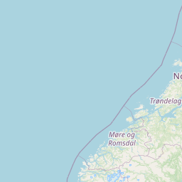
Distance Map Between Alesund and Dublin
Alesund, Molde, Norway ↔ Dublin, Swords, Ireland = 776 miles = 1248 km.


How far is it between Ålesund and Dublin
Alesund is located in Norway with (62.4723,6.1549) coordinates and Dublin is located in Ireland with (53.3331,-6.2489) coordinates. The calculated flying distance from Alesund to Dublin is equal to 776 miles which is equal to 1248 km.
If you want to go by car, the driving distance between Alesund and Dublin is 2881.22 km. If you ride your car with an average speed of 112 kilometers/hour (70 miles/h), travel time will be 25 hours 43 minutes. Please check the avg. speed travel time table on the right for various options.
Difference between fly and go by a car is 1633 km.
| City/Place | Latitude and Longitude | GPS Coordinates |
|---|---|---|
| Alesund | 62.4723, 6.1549 | 62° 28´ 20.1000'' N 6° 9´ 17.7120'' E |
| Dublin | 53.3331, -6.2489 | 53° 19´ 59.0160'' N 6° 14´ 56.0040'' W |
Estimated Travel Time Between Ålesund and Dublin
| Average Speed | Travel Time |
|---|---|
| 30 mph (48 km/h) | 60 hours 01 minutes |
| 40 mph (64 km/h) | 45 hours 01 minutes |
| 50 mph (80 km/h) | 36 hours 00 minutes |
| 60 mph (97 km/h) | 29 hours 42 minutes |
| 70 mph (112 km/h) | 25 hours 43 minutes |
| 75 mph (120 km/h) | 24 hours 00 minutes |
Related Distances to Dublin
| Cities | Distance |
|---|---|
| Larvik to Dublin | 2204 km |
| Bergen to Dublin | 2632 km |
| Oslo to Dublin | 2336 km |
| Drammen to Dublin | 2297 km |
| Stavanger to Dublin | 2405 km |
| Trondheim to Dublin | 2830 km |
| Kristiansand to Dublin | 2175 km |
| Tonsberg to Dublin | 2243 km |
| Horten to Dublin | 2257 km |
| Kristiansund to Dublin | 2907 km |