Distance from Alfortville to Cergy
Distance between Alfortville and Cergy is 36 kilometers (22 miles).
Driving distance from Alfortville to Cergy is 52 kilometers (32 miles).
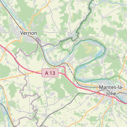
Distance Map Between Alfortville and Cergy
Alfortville, Paris, France ↔ Cergy, Paris, France = 22 miles = 36 km.


How far is it between Alfortville and Cergy
Alfortville is located in France with (48.8058,2.4204) coordinates and Cergy is located in France with (49.0365,2.0761) coordinates. The calculated flying distance from Alfortville to Cergy is equal to 22 miles which is equal to 36 km.
If you want to go by car, the driving distance between Alfortville and Cergy is 51.96 km. If you ride your car with an average speed of 112 kilometers/hour (70 miles/h), travel time will be 00 hours 27 minutes. Please check the avg. speed travel time table on the right for various options.
Difference between fly and go by a car is 16 km.
| City/Place | Latitude and Longitude | GPS Coordinates |
|---|---|---|
| Alfortville | 48.8058, 2.4204 | 48° 48´ 20.7000'' N 2° 25´ 13.4400'' E |
| Cergy | 49.0365, 2.0761 | 49° 2´ 11.2200'' N 2° 4´ 34.0680'' E |
Estimated Travel Time Between Alfortville and Cergy
| Average Speed | Travel Time |
|---|---|
| 30 mph (48 km/h) | 01 hours 04 minutes |
| 40 mph (64 km/h) | 00 hours 48 minutes |
| 50 mph (80 km/h) | 00 hours 38 minutes |
| 60 mph (97 km/h) | 00 hours 32 minutes |
| 70 mph (112 km/h) | 00 hours 27 minutes |
| 75 mph (120 km/h) | 00 hours 25 minutes |
Related Distances from Alfortville
| Cities | Distance |
|---|---|
| Alfortville to Antony | 20 km |
| Alfortville to Arcueil | 11 km |
| Alfortville to Argenteuil | 36 km |
| Alfortville to Asnieres Sur Seine | 25 km |
| Alfortville to Athis Mons | 21 km |
| Alfortville to Aubervilliers | 18 km |
| Alfortville to Aulnay Sous Bois | 21 km |
| Alfortville to Avon 2 | 73 km |
| Alfortville to Bagneux | 14 km |
| Alfortville to Bagnolet | 11 km |
Related Distances to Cergy
| Cities | Distance |
|---|---|
| Saint Quentin En Yvelines to Cergy | 40 km |
| Argenteuil to Cergy | 21 km |
| Alfortville to Cergy | 52 km |
| Asnieres Sur Seine to Cergy | 26 km |
| Boulogne Billancourt to Cergy | 36 km |
| Bondy to Cergy | 37 km |
| La Defense to Cergy | 33 km |
| Antony to Cergy | 60 km |
| Aulnay Sous Bois to Cergy | 41 km |
| Cachan to Cergy | 47 km |