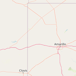
Distance from Amarillo to Mesquite
Distance between Amarillo and Mesquite is 554 kilometers (344 miles).
Driving distance from Amarillo to Mesquite is 607 kilometers (377 miles).
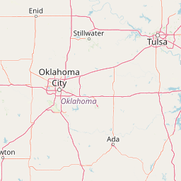
Distance Map Between Amarillo and Mesquite
Amarillo, Austin, United States ↔ Mesquite, Austin, United States = 344 miles = 554 km.


How far is it between Amarillo and Mesquite
Amarillo is located in United States with (35.222,-101.8313) coordinates and Mesquite is located in United States with (32.7668,-96.5992) coordinates. The calculated flying distance from Amarillo to Mesquite is equal to 344 miles which is equal to 554 km.
If you want to go by car, the driving distance between Amarillo and Mesquite is 607.36 km. If you ride your car with an average speed of 112 kilometers/hour (70 miles/h), travel time will be 05 hours 25 minutes. Please check the avg. speed travel time table on the right for various options.
Difference between fly and go by a car is 53 km.
| City/Place | Latitude and Longitude | GPS Coordinates |
|---|---|---|
| Amarillo | 35.222, -101.8313 | 35° 13´ 19.2000'' N 101° 49´ 52.6800'' W |
| Mesquite | 32.7668, -96.5992 | 32° 46´ 0.4800'' N 96° 35´ 56.9760'' W |
Estimated Travel Time Between Amarillo and Mesquite
| Average Speed | Travel Time |
|---|---|
| 30 mph (48 km/h) | 12 hours 39 minutes |
| 40 mph (64 km/h) | 09 hours 29 minutes |
| 50 mph (80 km/h) | 07 hours 35 minutes |
| 60 mph (97 km/h) | 06 hours 15 minutes |
| 70 mph (112 km/h) | 05 hours 25 minutes |
| 75 mph (120 km/h) | 05 hours 03 minutes |
Related Distances from Amarillo
| Cities | Distance |
|---|---|
| Amarillo to Dallas | 581 km |
| Amarillo to Houston | 965 km |
| Amarillo to San Antonio | 821 km |
| Amarillo to Abilene | 460 km |
| Amarillo to Fort Worth | 548 km |
Related Distances to Mesquite
| Cities | Distance |
|---|---|
| Las Vegas to Mesquite 2 | 130 km |
| Plano to Mesquite | 39 km |
| Rockwall to Mesquite | 31 km |
| Richardson to Mesquite | 28 km |
| Texas City to Mesquite | 455 km |