Distance from Amod to Khambhat
Distance between Amod and Khambhat is 44 kilometers (28 miles).
Driving distance from Amod to Khambhat is 103 kilometers (64 miles).
Distance Map Between Amod and Khambhat
Amod, Ghandinagar, India ↔ Khambhat, Ghandinagar, India = 28 miles = 44 km.


How far is it between Amod and Khambhāt
Amod is located in India with (21.9932,72.8705) coordinates and Khambhat is located in India with (22.3174,72.6192) coordinates. The calculated flying distance from Amod to Khambhat is equal to 28 miles which is equal to 44 km.
If you want to go by car, the driving distance between Amod and Khambhat is 102.69 km. If you ride your car with an average speed of 112 kilometers/hour (70 miles/h), travel time will be 00 hours 55 minutes. Please check the avg. speed travel time table on the right for various options.
Difference between fly and go by a car is 59 km.
| City/Place | Latitude and Longitude | GPS Coordinates |
|---|---|---|
| Amod | 21.9932, 72.8705 | 21° 59´ 35.4120'' N 72° 52´ 13.6920'' E |
| Khambhat | 22.3174, 72.6192 | 22° 19´ 2.7840'' N 72° 37´ 8.9760'' E |
Estimated Travel Time Between Amod and Khambhāt
| Average Speed | Travel Time |
|---|---|
| 30 mph (48 km/h) | 02 hours 08 minutes |
| 40 mph (64 km/h) | 01 hours 36 minutes |
| 50 mph (80 km/h) | 01 hours 17 minutes |
| 60 mph (97 km/h) | 01 hours 03 minutes |
| 70 mph (112 km/h) | 00 hours 55 minutes |
| 75 mph (120 km/h) | 00 hours 51 minutes |
Related Distances from Amod
| Cities | Distance |
|---|---|
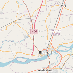
| Amod to Bharuch | 38 km |
| Amod to Jambusar | 12 km |
| Amod to Vadodara | 67 km |
| Amod to Ankleshwar | 52 km |
| Amod to Surat | 111 km |
Related Distances to Khambhat
| Cities | Distance |
|---|---|
| Ahmedabad to Khambhat | 89 km |
| Anand to Khambhat | 50 km |
| Ankleshwar to Khambhat | 148 km |
| Bhavnagar to Khambhat | 137 km |
| Dakor to Khambhat | 89 km |