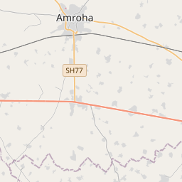
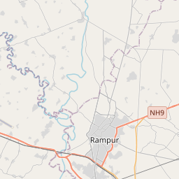
Distance from Amroha to Rampur
Distance between Amroha and Rampur is 55 kilometers (34 miles).
Driving distance from Amroha to Rampur is 64 kilometers (40 miles).
Distance Map Between Amroha and Rampur
Amroha, Lucknow, India ↔ Rampur, Lucknow, India = 34 miles = 55 km.


How far is it between Amroha and Rāmpur
Amroha is located in India with (28.9031,78.4698) coordinates and Rampur is located in India with (28.809,79.029) coordinates. The calculated flying distance from Amroha to Rampur is equal to 34 miles which is equal to 55 km.
If you want to go by car, the driving distance between Amroha and Rampur is 63.73 km. If you ride your car with an average speed of 112 kilometers/hour (70 miles/h), travel time will be 00 hours 34 minutes. Please check the avg. speed travel time table on the right for various options.
Difference between fly and go by a car is 9 km.
| City/Place | Latitude and Longitude | GPS Coordinates |
|---|---|---|
| Amroha | 28.9031, 78.4698 | 28° 54´ 11.3040'' N 78° 28´ 11.4240'' E |
| Rampur | 28.809, 79.029 | 28° 48´ 32.5440'' N 79° 1´ 44.2200'' E |
Estimated Travel Time Between Amroha and Rāmpur
| Average Speed | Travel Time |
|---|---|
| 30 mph (48 km/h) | 01 hours 19 minutes |
| 40 mph (64 km/h) | 00 hours 59 minutes |
| 50 mph (80 km/h) | 00 hours 47 minutes |
| 60 mph (97 km/h) | 00 hours 39 minutes |
| 70 mph (112 km/h) | 00 hours 34 minutes |
| 75 mph (120 km/h) | 00 hours 31 minutes |
Related Distances from Amroha
| Cities | Distance |
|---|---|
| Amroha to Sambhal | 39 km |
| Amroha to Bijnor | 70 km |
| Amroha to Kanth | 26 km |
| Amroha to Dhanaura | 23 km |
| Amroha to Hasanpur | 33 km |
Related Distances to Rampur
| Cities | Distance |
|---|---|
| Moradabad to Rampur | 29 km |
| Milak to Rampur | 27 km |
| Bareilly to Rampur | 71 km |
| Bijnor to Rampur | 115 km |
| Mandsaur to Rampura 2 | 89 km |