Distance from Antwerpen to Gent
Distance between Antwerpen and Gent is 52 kilometers (32 miles).
Driving distance from Antwerpen to Gent is 60 kilometers (37 miles).
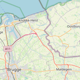
Distance Map Between Antwerpen and Gent
Antwerpen, , Belgium ↔ Gent, , Belgium = 32 miles = 52 km.


How far is it between Antwerpen and Gent
Antwerpen is located in Belgium with (51.2199,4.4035) coordinates and Gent is located in Belgium with (51.05,3.7167) coordinates. The calculated flying distance from Antwerpen to Gent is equal to 32 miles which is equal to 52 km.
If you want to go by car, the driving distance between Antwerpen and Gent is 59.67 km. If you ride your car with an average speed of 112 kilometers/hour (70 miles/h), travel time will be 00 hours 31 minutes. Please check the avg. speed travel time table on the right for various options.
Difference between fly and go by a car is 8 km.
| City/Place | Latitude and Longitude | GPS Coordinates |
|---|---|---|
| Antwerpen | 51.2199, 4.4035 | 51° 13´ 11.6040'' N 4° 24´ 12.4560'' E |
| Gent | 51.05, 3.7167 | 51° 2´ 60.0000'' N 3° 43´ 0.0120'' E |
Estimated Travel Time Between Antwerpen and Gent
| Average Speed | Travel Time |
|---|---|
| 30 mph (48 km/h) | 01 hours 14 minutes |
| 40 mph (64 km/h) | 00 hours 55 minutes |
| 50 mph (80 km/h) | 00 hours 44 minutes |
| 60 mph (97 km/h) | 00 hours 36 minutes |
| 70 mph (112 km/h) | 00 hours 31 minutes |
| 75 mph (120 km/h) | 00 hours 29 minutes |
Related Distances from Antwerpen
| Cities | Distance |
|---|---|
| Antwerpen to Brussels | 45 km |
| Antwerpen to Brugge | 103 km |
| Antwerpen to Boom | 16 km |
| Antwerpen to Mechelen | 27 km |
| Antwerpen to Mol | 58 km |
Related Distances to Gent
| Cities | Distance |
|---|---|
| Brugge to Gent | 46 km |
| Genk to Gent | 151 km |
| Boom to Gent | 60 km |
| Aalst to Gent | 33 km |
| Antwerpen to Gent | 60 km |