Distance from Apalit to Obando
Distance between Apalit and Obando is 32 kilometers (20 miles).
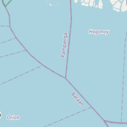
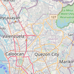
Driving distance from Apalit to Obando is 50 kilometers (31 miles).
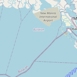
Distance Map Between Apalit and Obando
Apalit, , Philippines ↔ Obando, , Philippines = 20 miles = 32 km.


How far is it between Apalit and Obando
Apalit is located in Philippines with (14.9533,120.77) coordinates and Obando is located in Philippines with (14.7098,120.9362) coordinates. The calculated flying distance from Apalit to Obando is equal to 20 miles which is equal to 32 km.
If you want to go by car, the driving distance between Apalit and Obando is 49.79 km. If you ride your car with an average speed of 112 kilometers/hour (70 miles/h), travel time will be 00 hours 26 minutes. Please check the avg. speed travel time table on the right for various options.
Difference between fly and go by a car is 18 km.
| City/Place | Latitude and Longitude | GPS Coordinates |
|---|---|---|
| Apalit | 14.9533, 120.77 | 14° 57´ 11.9880'' N 120° 46´ 12.0000'' E |
| Obando | 14.7098, 120.9362 | 14° 42´ 35.2800'' N 120° 56´ 10.3200'' E |
Estimated Travel Time Between Apalit and Obando
| Average Speed | Travel Time |
|---|---|
| 30 mph (48 km/h) | 01 hours 02 minutes |
| 40 mph (64 km/h) | 00 hours 46 minutes |
| 50 mph (80 km/h) | 00 hours 37 minutes |
| 60 mph (97 km/h) | 00 hours 30 minutes |
| 70 mph (112 km/h) | 00 hours 26 minutes |
| 75 mph (120 km/h) | 00 hours 24 minutes |
Related Distances from Apalit
| Cities | Distance |
|---|---|
| Apalit to San Fernando | 13 km |
| Apalit to Malolos | 16 km |
| Apalit to Mexico | 19 km |
| Apalit to Arayat | 25 km |
| Apalit to San Simon | 8 km |
Related Distances to Obando
| Cities | Distance |
|---|---|
| Malolos to Obando | 23 km |
| Bulacan to Obando | 12 km |
| Meycauayan to Obando | 6 km |
| Apalit to Obando | 50 km |
| Calumpit to Obando | 39 km |