Distance from Arapongas to Lapa
Distance between Arapongas and Lapa is 313 kilometers (195 miles).
Driving distance from Arapongas to Lapa is 367 kilometers (228 miles).
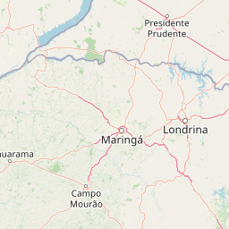
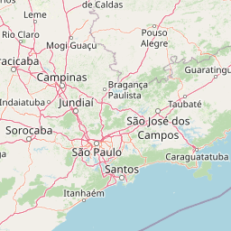
Distance Map Between Arapongas and Lapa
Arapongas, Curitiba, Brazil ↔ Lapa, Curitiba, Brazil = 195 miles = 313 km.


How far is it between Arapongas and Lapa
Arapongas is located in Brazil with (-23.4194,-51.4244) coordinates and Lapa is located in Brazil with (-25.7697,-49.7158) coordinates. The calculated flying distance from Arapongas to Lapa is equal to 195 miles which is equal to 313 km.
If you want to go by car, the driving distance between Arapongas and Lapa is 366.57 km. If you ride your car with an average speed of 112 kilometers/hour (70 miles/h), travel time will be 03 hours 16 minutes. Please check the avg. speed travel time table on the right for various options.
Difference between fly and go by a car is 54 km.
| City/Place | Latitude and Longitude | GPS Coordinates |
|---|---|---|
| Arapongas | -23.4194, -51.4244 | 23° 25´ 9.9840'' S 51° 25´ 27.9840'' W |
| Lapa | -25.7697, -49.7158 | 25° 46´ 10.9920'' S 49° 42´ 56.9880'' W |
Estimated Travel Time Between Arapongas and Lapa
| Average Speed | Travel Time |
|---|---|
| 30 mph (48 km/h) | 07 hours 38 minutes |
| 40 mph (64 km/h) | 05 hours 43 minutes |
| 50 mph (80 km/h) | 04 hours 34 minutes |
| 60 mph (97 km/h) | 03 hours 46 minutes |
| 70 mph (112 km/h) | 03 hours 16 minutes |
| 75 mph (120 km/h) | 03 hours 03 minutes |
Related Distances from Arapongas
| Cities | Distance |
|---|---|
| Arapongas to Araucaria | 374 km |
| Arapongas to Astorga | 35 km |
| Arapongas to Bandeirantes | 137 km |
| Arapongas to Cambara | 171 km |
| Arapongas to Cambe | 25 km |
| Arapongas to Campina Grande Do Sul | 420 km |
| Arapongas to Campo Largo | 352 km |
| Arapongas to Campo Mourao | 153 km |
| Arapongas to Cascavel | 339 km |
| Arapongas to Castro | 271 km |
Related Distances to Lapa
| Cities | Distance |
|---|---|
| Cruzeiro Do Oeste to Lapa | 534 km |
| Guaratuba to Lapa | 181 km |
| Almirante Tamandare to Lapa | 85 km |
| Araucaria to Lapa | 43 km |
| Itaperucu to Lapa | 104 km |
| Antonina to Lapa | 145 km |
| Imbituva to Lapa | 153 km |
| Francisco Beltrao to Lapa | 445 km |
| Campo Mourao to Lapa | 431 km |
| Bandeirantes to Lapa | 395 km |