Distance from Arcata to Modesto
Distance between Arcata and Modesto is 446 kilometers (277 miles).
Driving distance from Arcata to Modesto is 584 kilometers (363 miles).
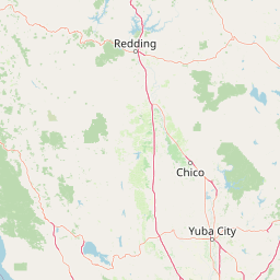
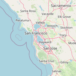
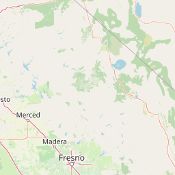
Distance Map Between Arcata and Modesto
Arcata, Sacramento, United States ↔ Modesto, Sacramento, United States = 277 miles = 446 km.


How far is it between Arcata and Modesto
Arcata is located in United States with (40.8665,-124.0828) coordinates and Modesto is located in United States with (37.6391,-120.9969) coordinates. The calculated flying distance from Arcata to Modesto is equal to 277 miles which is equal to 446 km.
If you want to go by car, the driving distance between Arcata and Modesto is 584.3 km. If you ride your car with an average speed of 112 kilometers/hour (70 miles/h), travel time will be 05 hours 13 minutes. Please check the avg. speed travel time table on the right for various options.
Difference between fly and go by a car is 138 km.
| City/Place | Latitude and Longitude | GPS Coordinates |
|---|---|---|
| Arcata | 40.8665, -124.0828 | 40° 51´ 59.4720'' N 124° 4´ 58.2240'' W |
| Modesto | 37.6391, -120.9969 | 37° 38´ 20.7600'' N 120° 59´ 48.7680'' W |
Estimated Travel Time Between Arcata and Modesto
| Average Speed | Travel Time |
|---|---|
| 30 mph (48 km/h) | 12 hours 10 minutes |
| 40 mph (64 km/h) | 09 hours 07 minutes |
| 50 mph (80 km/h) | 07 hours 18 minutes |
| 60 mph (97 km/h) | 06 hours 01 minutes |
| 70 mph (112 km/h) | 05 hours 13 minutes |
| 75 mph (120 km/h) | 04 hours 52 minutes |
Related Distances from Arcata
| Cities | Distance |
|---|---|
| Arcata to San Francisco | 450 km |
| Arcata to Los Angeles | 1103 km |
| Arcata to Vacaville | 466 km |
| Arcata to Oakland | 456 km |
| Arcata to Daly City | 455 km |
Related Distances to Modesto
| Cities | Distance |
|---|---|
| Stockton to Modesto | 51 km |
| San Francisco to Modesto | 148 km |
| San Jose to Modesto | 146 km |
| Patterson to Modesto | 27 km |
| Oakley to Modesto | 94 km |