Distance from Ashland to Fairborn
Distance between Ashland and Fairborn is 185 kilometers (115 miles).
Driving distance from Ashland to Fairborn is 227 kilometers (141 miles).
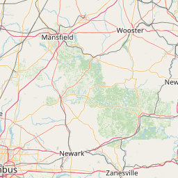
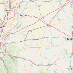
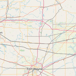
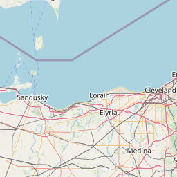
Distance Map Between Ashland and Fairborn
Ashland, Columbus, United States ↔ Fairborn, Columbus, United States = 115 miles = 185 km.


How far is it between Ashland and Fairborn
Ashland is located in United States with (40.8687,-82.3182) coordinates and Fairborn is located in United States with (39.8209,-84.0194) coordinates. The calculated flying distance from Ashland to Fairborn is equal to 115 miles which is equal to 185 km.
If you want to go by car, the driving distance between Ashland and Fairborn is 227.04 km. If you ride your car with an average speed of 112 kilometers/hour (70 miles/h), travel time will be 02 hours 01 minutes. Please check the avg. speed travel time table on the right for various options.
Difference between fly and go by a car is 42 km.
| City/Place | Latitude and Longitude | GPS Coordinates |
|---|---|---|
| Ashland | 40.8687, -82.3182 | 40° 52´ 7.2120'' N 82° 19´ 5.5920'' W |
| Fairborn | 39.8209, -84.0194 | 39° 49´ 15.2040'' N 84° 1´ 9.7680'' W |
Estimated Travel Time Between Ashland and Fairborn
| Average Speed | Travel Time |
|---|---|
| 30 mph (48 km/h) | 04 hours 43 minutes |
| 40 mph (64 km/h) | 03 hours 32 minutes |
| 50 mph (80 km/h) | 02 hours 50 minutes |
| 60 mph (97 km/h) | 02 hours 20 minutes |
| 70 mph (112 km/h) | 02 hours 01 minutes |
| 75 mph (120 km/h) | 01 hours 53 minutes |
Related Distances from Ashland
| Cities | Distance |
|---|---|
| Ashland 3 to Athens 3 | 248 km |
| Ashland 3 to Cincinnati | 295 km |
| Ashland 3 to Akron | 80 km |
| Ashland 3 to Lancaster 4 | 180 km |
| Ashland 3 to Dayton | 244 km |
Related Distances to Fairborn
| Cities | Distance |
|---|---|
| Dayton to Fairborn | 19 km |
| Huber Heights to Fairborn | 12 km |
| Cincinnati to Fairborn | 99 km |
| Kent 2 to Fairborn | 315 km |
| Xenia to Fairborn | 19 km |