Distance from Ashta to Dewas
Distance between Ashta and Dewas is 68 kilometers (42 miles).
Driving distance from Ashta to Dewas is 75 kilometers (46 miles).
Distance Map Between Ashta and Dewas
Ashta, Bhopal, India ↔ Dewas, Bhopal, India = 42 miles = 68 km.

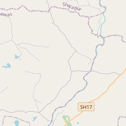

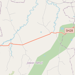


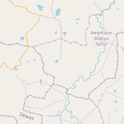

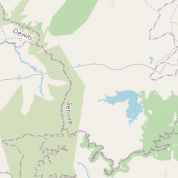

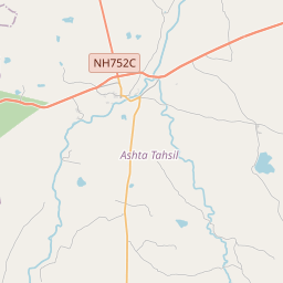


Leaflet | © OpenStreetMap
How far is it between Ashta and Dewas
Ashta is located in India with (23.0179,76.7202) coordinates and Dewas is located in India with (22.9659,76.0553) coordinates. The calculated flying distance from Ashta to Dewas is equal to 42 miles which is equal to 68 km.
If you want to go by car, the driving distance between Ashta and Dewas is 74.53 km. If you ride your car with an average speed of 112 kilometers/hour (70 miles/h), travel time will be 00 hours 39 minutes. Please check the avg. speed travel time table on the right for various options.
Difference between fly and go by a car is 7 km.
| City/Place | Latitude and Longitude | GPS Coordinates |
|---|---|---|
| Ashta | 23.0179, 76.7202 | 23° 1´ 4.4400'' N 76° 43´ 12.8640'' E |
| Dewas | 22.9659, 76.0553 | 22° 57´ 57.0600'' N 76° 3´ 18.9360'' E |
Estimated Travel Time Between Ashta and Dewas
| Average Speed | Travel Time |
|---|---|
| 30 mph (48 km/h) | 01 hours 33 minutes |
| 40 mph (64 km/h) | 01 hours 09 minutes |
| 50 mph (80 km/h) | 00 hours 55 minutes |
| 60 mph (97 km/h) | 00 hours 46 minutes |
| 70 mph (112 km/h) | 00 hours 39 minutes |
| 75 mph (120 km/h) | 00 hours 37 minutes |
Ashta, Bhopal, India
Related Distances from Ashta
| Cities | Distance |
|---|---|
| Ashta to Indore | 120 km |
| Ashta to Sehore | 44 km |
| Ashta to Dewas | 75 km |
| Ashta to Ujjain | 117 km |
| Ashta to Shujalpur | 51 km |
Dewas, Bhopal, India
Related Distances to Dewas
| Cities | Distance |
|---|---|
| Ashta to Dewas | 75 km |
| Agar to Dewas | 105 km |
| Pithampur to Dewas | 66 km |
| Depalpur to Dewas | 80 km |
| Badnawar to Dewas | 104 km |