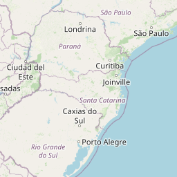
Distance from Astorga to Castro
Distance between Astorga and Castro is 241 kilometers (150 miles).
Distance Map Between Astorga and Castro
Astorga, Curitiba, Brazil ↔ Castro, Curitiba, Brazil = 150 miles = 241 km.


Leaflet | © OpenStreetMap
How far is it between Astorga and Castro
Astorga is located in Brazil with (-23.2325,-51.6656) coordinates and Castro is located in Brazil with (-24.7893,-50.0123) coordinates. The calculated flying distance from Astorga to Castro is equal to 150 miles which is equal to 241 km.
| City/Place | Latitude and Longitude | GPS Coordinates |
|---|---|---|
| Astorga | -23.2325, -51.6656 | 23° 13´ 57.0000'' S 51° 39´ 56.0160'' W |
| Castro | -24.7893, -50.0123 | 24° 47´ 21.3720'' S 50° 0´ 44.1000'' W |
Astorga, Curitiba, Brazil
Related Distances from Astorga
| Cities | Distance |
|---|---|
| Astorga to Laranjeiras Do Sul | 385 km |
| Astorga to Loanda | 179 km |
| Astorga to Foz Do Iguacu | 468 km |
| Astorga to Sao Mateus Do Sul | 427 km |
| Astorga to Telemaco Borba | 227 km |
Castro, Curitiba, Brazil
Related Distances to Castro
| Cities | Distance |
|---|---|
| Campo Mourao to Castro | 372 km |
| Cambara to Castro | 243 km |
| Cambe to Castro | 280 km |
| Antonina to Castro | 250 km |
| Apucarana to Castro | 256 km |