Distance from Austintown to Dayton
Distance between Austintown and Dayton is 326 kilometers (203 miles).
Driving distance from Austintown to Dayton is 380 kilometers (236 miles).
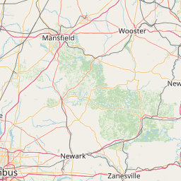
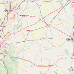
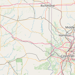
Distance Map Between Austintown and Dayton
Austintown, Columbus, United States ↔ Dayton, Columbus, United States = 203 miles = 326 km.


How far is it between Austintown and Dayton
Austintown is located in United States with (41.1017,-80.7645) coordinates and Dayton is located in United States with (39.759,-84.1916) coordinates. The calculated flying distance from Austintown to Dayton is equal to 203 miles which is equal to 326 km.
If you want to go by car, the driving distance between Austintown and Dayton is 380.48 km. If you ride your car with an average speed of 112 kilometers/hour (70 miles/h), travel time will be 03 hours 23 minutes. Please check the avg. speed travel time table on the right for various options.
Difference between fly and go by a car is 54 km.
| City/Place | Latitude and Longitude | GPS Coordinates |
|---|---|---|
| Austintown | 41.1017, -80.7645 | 41° 6´ 6.1920'' N 80° 45´ 52.2720'' W |
| Dayton | 39.759, -84.1916 | 39° 45´ 32.2200'' N 84° 11´ 29.7960'' W |
Estimated Travel Time Between Austintown and Dayton
| Average Speed | Travel Time |
|---|---|
| 30 mph (48 km/h) | 07 hours 55 minutes |
| 40 mph (64 km/h) | 05 hours 56 minutes |
| 50 mph (80 km/h) | 04 hours 45 minutes |
| 60 mph (97 km/h) | 03 hours 55 minutes |
| 70 mph (112 km/h) | 03 hours 23 minutes |
| 75 mph (120 km/h) | 03 hours 10 minutes |
Related Distances from Austintown
| Cities | Distance |
|---|---|
| Austintown to Akron | 72 km |
| Austintown to Alliance | 53 km |
| Austintown to Ashland 3 | 147 km |
| Austintown to Ashtabula | 96 km |
| Austintown to Athens 3 | 358 km |
| Austintown to Aurora 4 | 69 km |
| Austintown to Beavercreek | 383 km |
| Austintown to Centerville | 393 km |
| Austintown to Chillicothe | 347 km |
| Austintown to Cincinnati | 432 km |
Related Distances to Dayton
| Cities | Distance |
|---|---|
| Jasmine Estates to Daytona Beach | 233 km |
| Zanesville to Dayton | 202 km |
| Lakeland to Daytona Beach | 177 km |
| Forest Park to Dayton | 68 km |
| North Miami to Daytona Beach | 407 km |
| Lima 2 to Dayton | 122 km |
| Westchase to Daytona Beach | 248 km |
| Chillicothe to Dayton | 124 km |
| Kent 2 to Dayton | 332 km |
| Kettering to Dayton | 8 km |