Distance from Ayodhya to Bansi
Distance between Ayodhya and Bansi is 84 kilometers (52 miles).
Driving distance from Ayodhya to Bansi is 113 kilometers (70 miles).
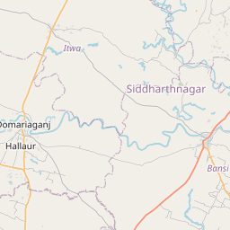
Distance Map Between Ayodhya and Bansi
Ayodhya, Lucknow, India ↔ Bansi, Lucknow, India = 52 miles = 84 km.


How far is it between Ayodhya and Bānsi
Ayodhya is located in India with (26.7996,82.2041) coordinates and Bansi is located in India with (27.1798,82.9341) coordinates. The calculated flying distance from Ayodhya to Bansi is equal to 52 miles which is equal to 84 km.
If you want to go by car, the driving distance between Ayodhya and Bansi is 112.77 km. If you ride your car with an average speed of 112 kilometers/hour (70 miles/h), travel time will be 01 hours 00 minutes. Please check the avg. speed travel time table on the right for various options.
Difference between fly and go by a car is 29 km.
| City/Place | Latitude and Longitude | GPS Coordinates |
|---|---|---|
| Ayodhya | 26.7996, 82.2041 | 26° 47´ 58.5240'' N 82° 12´ 14.9040'' E |
| Bansi | 27.1798, 82.9341 | 27° 10´ 47.2440'' N 82° 56´ 2.7240'' E |
Estimated Travel Time Between Ayodhya and Bānsi
| Average Speed | Travel Time |
|---|---|
| 30 mph (48 km/h) | 02 hours 20 minutes |
| 40 mph (64 km/h) | 01 hours 45 minutes |
| 50 mph (80 km/h) | 01 hours 24 minutes |
| 60 mph (97 km/h) | 01 hours 09 minutes |
| 70 mph (112 km/h) | 01 hours 00 minutes |
| 75 mph (120 km/h) | 00 hours 56 minutes |
Related Distances from Ayodhya
| Cities | Distance |
|---|---|
| Ayodhya to Nawabganj 4 | 14 km |
| Ayodhya to Tanda 2 | 59 km |
| Ayodhya to Lalganj 2 | 137 km |
| Ayodhya to Varanasi | 213 km |
| Ayodhya to Utraula | 72 km |
Related Distances to Bansi
| Cities | Distance |
|---|---|
| Balrampur to Bansi | 111 km |
| Ayodhya to Bansi | 113 km |
| Bahraich to Bansi | 150 km |
| Azamgarh to Bansi | 168 km |
| Allahabad to Bansi | 290 km |