Distance from Badami to Nargund
Distance between Badami and Nargund is 38 kilometers (23 miles).
Driving distance from Badami to Nargund is 45 kilometers (28 miles).
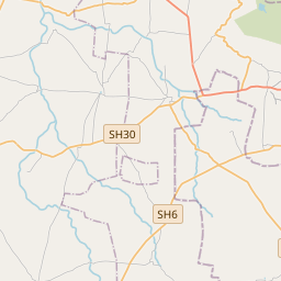
Distance Map Between Badami and Nargund
Badami, Bangalore, India ↔ Nargund, Bangalore, India = 23 miles = 38 km.


How far is it between Bādāmi and Nargund
Badami is located in India with (15.915,75.6768) coordinates and Nargund is located in India with (15.723,75.3867) coordinates. The calculated flying distance from Badami to Nargund is equal to 23 miles which is equal to 38 km.
If you want to go by car, the driving distance between Badami and Nargund is 45.29 km. If you ride your car with an average speed of 112 kilometers/hour (70 miles/h), travel time will be 00 hours 24 minutes. Please check the avg. speed travel time table on the right for various options.
Difference between fly and go by a car is 7 km.
| City/Place | Latitude and Longitude | GPS Coordinates |
|---|---|---|
| Badami | 15.915, 75.6768 | 15° 54´ 53.8200'' N 75° 40´ 36.5880'' E |
| Nargund | 15.723, 75.3867 | 15° 43´ 22.7640'' N 75° 23´ 11.9760'' E |
Estimated Travel Time Between Bādāmi and Nargund
| Average Speed | Travel Time |
|---|---|
| 30 mph (48 km/h) | 00 hours 56 minutes |
| 40 mph (64 km/h) | 00 hours 42 minutes |
| 50 mph (80 km/h) | 00 hours 33 minutes |
| 60 mph (97 km/h) | 00 hours 28 minutes |
| 70 mph (112 km/h) | 00 hours 24 minutes |
| 75 mph (120 km/h) | 00 hours 22 minutes |
Related Distances from Badami
| Cities | Distance |
|---|---|
| Badami to Ilkal | 60 km |
| Badami to Saundatti | 82 km |
| Badami to Nargund | 45 km |
| Badami to Jamkhandi | 98 km |
| Badami to Mudhol | 78 km |
Related Distances to Nargund
| Cities | Distance |
|---|---|
| Hubli to Nargund | 59 km |
| Gadag to Nargund | 47 km |
| Bagalkot to Nargund | 68 km |
| Badami to Nargund | 45 km |
| Konnur to Nargund | 93 km |