Distance from Baguio to Manila
Distance between Baguio and Manila is 206 kilometers (128 miles).
Driving distance from Baguio to Manila is 248 kilometers (154 miles).
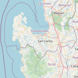
Distance Map Between Baguio and Manila
Baguio, Philippines ↔ Manila, Philippines = 128 miles = 206 km.


How far is it between Baguio and Manila
Baguio is located in Philippines with (16.4164,120.5931) coordinates and Manila is located in Philippines with (14.6042,120.9822) coordinates. The calculated flying distance from Baguio to Manila is equal to 128 miles which is equal to 206 km.
If you want to go by car, the driving distance between Baguio and Manila is 248.39 km. If you ride your car with an average speed of 112 kilometers/hour (70 miles/h), travel time will be 02 hours 13 minutes. Please check the avg. speed travel time table on the right for various options.
Difference between fly and go by a car is 42 km.
| City/Place | Latitude and Longitude | GPS Coordinates |
|---|---|---|
| Baguio | 16.4164, 120.5931 | 16° 24´ 59.0040'' N 120° 35´ 35.0160'' E |
| Manila | 14.6042, 120.9822 | 14° 36´ 15.1200'' N 120° 58´ 55.9200'' E |
Estimated Travel Time Between Baguio and Manila
| Average Speed | Travel Time |
|---|---|
| 30 mph (48 km/h) | 05 hours 10 minutes |
| 40 mph (64 km/h) | 03 hours 52 minutes |
| 50 mph (80 km/h) | 03 hours 06 minutes |
| 60 mph (97 km/h) | 02 hours 33 minutes |
| 70 mph (112 km/h) | 02 hours 13 minutes |
| 75 mph (120 km/h) | 02 hours 04 minutes |
Related Distances from Baguio
| Cities | Distance |
|---|---|
| Baguio to Manila | 248 km |
| Baguio to Tuguegarao City | 320 km |
| Baguio to San Fernando 3 | 57 km |
| Baguio to Cebu City | 1099 km |
| Baguio to Davao | 1714 km |
Related Distances to Manila
| Cities | Distance |
|---|---|
| Baguio to Manila | 248 km |
| Davao to Manila | 1476 km |
| Cebu City to Manila | 850 km |
| Cagayan De Oro to Manila | 1371 km |
| Iloilo to Manila | 651 km |