Distance from Bah to Pilibhit
Distance between Bah and Pilibhit is 229 kilometers (142 miles).
Driving distance from Bah to Pilibhit is 333 kilometers (207 miles).
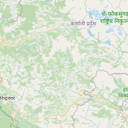
Distance Map Between Bah and Pilibhit
Bah, Lucknow, India ↔ Pilibhit, Lucknow, India = 142 miles = 229 km.


How far is it between Bāh and Pīlībhīt
Bah is located in India with (26.8699,78.5944) coordinates and Pilibhit is located in India with (28.631,79.8034) coordinates. The calculated flying distance from Bah to Pilibhit is equal to 142 miles which is equal to 229 km.
If you want to go by car, the driving distance between Bah and Pilibhit is 333.44 km. If you ride your car with an average speed of 112 kilometers/hour (70 miles/h), travel time will be 02 hours 58 minutes. Please check the avg. speed travel time table on the right for various options.
Difference between fly and go by a car is 104 km.
| City/Place | Latitude and Longitude | GPS Coordinates |
|---|---|---|
| Bah | 26.8699, 78.5944 | 26° 52´ 11.6760'' N 78° 35´ 39.9480'' E |
| Pilibhit | 28.631, 79.8034 | 28° 37´ 51.5280'' N 79° 48´ 12.1680'' E |
Estimated Travel Time Between Bāh and Pīlībhīt
| Average Speed | Travel Time |
|---|---|
| 30 mph (48 km/h) | 06 hours 56 minutes |
| 40 mph (64 km/h) | 05 hours 12 minutes |
| 50 mph (80 km/h) | 04 hours 10 minutes |
| 60 mph (97 km/h) | 03 hours 26 minutes |
| 70 mph (112 km/h) | 02 hours 58 minutes |
| 75 mph (120 km/h) | 02 hours 46 minutes |
Related Distances from Bah
| Cities | Distance |
|---|---|
| Bah to Etawah | 45 km |
| Bah to Firozabad | 53 km |
| Bah to Shikohabad | 32 km |
| Bah to Kanpur | 209 km |
| Bah to Mainpuri | 81 km |
Related Distances to Pilibhit
| Cities | Distance |
|---|---|
| Bisalpur to Pilibhit | 39 km |
| Nawabganj 3 to Pilibhit | 21 km |
| Palia Kalan to Pilibhit | 118 km |
| Bareilly to Pilibhit | 57 km |
| Bilsanda to Pilibhit | 55 km |