Distance from Baiquan to Taihe
Distance between Baiquan and Taihe is 417 kilometers (259 miles).
Driving distance from Baiquan to Taihe is 669 kilometers (416 miles).
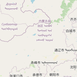
Distance Map Between Baiquan and Taihe
Baiquan, Harbin, China ↔ Taihe, Harbin, China = 259 miles = 417 km.


How far is it between Baiquan and Taihe
Baiquan is located in China with (47.6061,126.0848) coordinates and Taihe is located in China with (45.762,130.8513) coordinates. The calculated flying distance from Baiquan to Taihe is equal to 259 miles which is equal to 417 km.
If you want to go by car, the driving distance between Baiquan and Taihe is 669.29 km. If you ride your car with an average speed of 112 kilometers/hour (70 miles/h), travel time will be 05 hours 58 minutes. Please check the avg. speed travel time table on the right for various options.
Difference between fly and go by a car is 252 km.
| City/Place | Latitude and Longitude | GPS Coordinates |
|---|---|---|
| Baiquan | 47.6061, 126.0848 | 47° 36´ 21.7800'' N 126° 5´ 5.3160'' E |
| Taihe | 45.762, 130.8513 | 45° 45´ 43.0200'' N 130° 51´ 4.7160'' E |
Estimated Travel Time Between Baiquan and Taihe
| Average Speed | Travel Time |
|---|---|
| 30 mph (48 km/h) | 13 hours 56 minutes |
| 40 mph (64 km/h) | 10 hours 27 minutes |
| 50 mph (80 km/h) | 08 hours 21 minutes |
| 60 mph (97 km/h) | 06 hours 53 minutes |
| 70 mph (112 km/h) | 05 hours 58 minutes |
| 75 mph (120 km/h) | 05 hours 34 minutes |
Related Distances from Baiquan
| Cities | Distance |
|---|---|
| Baiquan to Wuchang | 406 km |
| Baiquan to Hailin | 598 km |
| Baiquan to Lanxi 2 | 163 km |
| Baiquan to Heihe | 351 km |
| Baiquan to Hailun | 77 km |
Related Distances to Taihe
| Cities | Distance |
|---|---|
| Qiqihar to Taihe | 701 km |
| Boli to Taihe | 26 km |
| Qinggang to Taihe | 509 km |
| Binzhou 2 to Taihe | 325 km |
| Langxiang to Taihe | 359 km |