Distance from Baj Baj to Ghatal
Distance between Baj Baj and Ghatal is 50 kilometers (31 miles).
Driving distance from Baj Baj to Ghatal is 107 kilometers (66 miles).
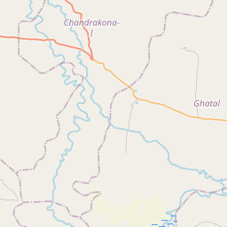
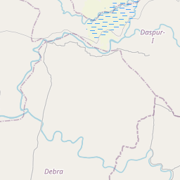
Distance Map Between Baj Baj and Ghatal
Baj Baj, Kolkata, India ↔ Ghatal, Kolkata, India = 31 miles = 50 km.


How far is it between Baj Baj and Ghātāl
Baj Baj is located in India with (22.4751,88.1777) coordinates and Ghatal is located in India with (22.6624,87.734) coordinates. The calculated flying distance from Baj Baj to Ghatal is equal to 31 miles which is equal to 50 km.
If you want to go by car, the driving distance between Baj Baj and Ghatal is 106.51 km. If you ride your car with an average speed of 112 kilometers/hour (70 miles/h), travel time will be 00 hours 57 minutes. Please check the avg. speed travel time table on the right for various options.
Difference between fly and go by a car is 57 km.
| City/Place | Latitude and Longitude | GPS Coordinates |
|---|---|---|
| Baj Baj | 22.4751, 88.1777 | 22° 28´ 30.5040'' N 88° 10´ 39.6120'' E |
| Ghatal | 22.6624, 87.734 | 22° 39´ 44.7840'' N 87° 44´ 2.3640'' E |
Estimated Travel Time Between Baj Baj and Ghātāl
| Average Speed | Travel Time |
|---|---|
| 30 mph (48 km/h) | 02 hours 13 minutes |
| 40 mph (64 km/h) | 01 hours 39 minutes |
| 50 mph (80 km/h) | 01 hours 19 minutes |
| 60 mph (97 km/h) | 01 hours 05 minutes |
| 70 mph (112 km/h) | 00 hours 57 minutes |
| 75 mph (120 km/h) | 00 hours 53 minutes |
Related Distances from Baj Baj
| Cities | Distance |
|---|---|
| Baj Baj to Tarakeswar | 85 km |
| Baj Baj to Kishanganj | 496 km |
| Baj Baj to Khardah | 42 km |
| Baj Baj to Fort Gloster | 13 km |
| Baj Baj to Barasat 2 | 49 km |
Related Distances to Ghatal
| Cities | Distance |
|---|---|
| Arambagh to Ghatal | 36 km |
| Chandrakona to Ghatal | 26 km |
| Barddhaman to Ghatal | 83 km |
| Haldia to Ghatal | 99 km |
| Bankura to Ghatal | 109 km |