Distance from Balanga to Paombong
Distance between Balanga and Paombong is 32 kilometers (20 miles).
Driving distance from Balanga to Paombong is 94 kilometers (58 miles).
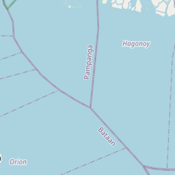
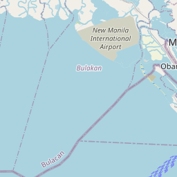
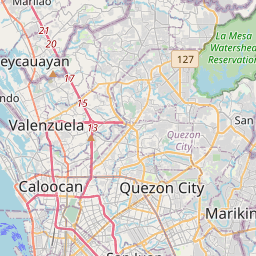
Distance Map Between Balanga and Paombong
Balanga, , Philippines ↔ Paombong, , Philippines = 20 miles = 32 km.


How far is it between Balanga and Paombong
Balanga is located in Philippines with (14.6761,120.5361) coordinates and Paombong is located in Philippines with (14.8311,120.7892) coordinates. The calculated flying distance from Balanga to Paombong is equal to 20 miles which is equal to 32 km.
If you want to go by car, the driving distance between Balanga and Paombong is 93.93 km. If you ride your car with an average speed of 112 kilometers/hour (70 miles/h), travel time will be 00 hours 50 minutes. Please check the avg. speed travel time table on the right for various options.
Difference between fly and go by a car is 62 km.
| City/Place | Latitude and Longitude | GPS Coordinates |
|---|---|---|
| Balanga | 14.6761, 120.5361 | 14° 40´ 33.9960'' N 120° 32´ 9.9960'' E |
| Paombong | 14.8311, 120.7892 | 14° 49´ 51.9960'' N 120° 47´ 21.0120'' E |
Estimated Travel Time Between Balanga and Paombong
| Average Speed | Travel Time |
|---|---|
| 30 mph (48 km/h) | 01 hours 57 minutes |
| 40 mph (64 km/h) | 01 hours 28 minutes |
| 50 mph (80 km/h) | 01 hours 10 minutes |
| 60 mph (97 km/h) | 00 hours 58 minutes |
| 70 mph (112 km/h) | 00 hours 50 minutes |
| 75 mph (120 km/h) | 00 hours 46 minutes |
Related Distances from Balanga
| Cities | Distance |
|---|---|
| Balanga to Baliuag | 89 km |
| Balanga to Bocaue | 97 km |
| Balanga to Bongabon | 170 km |
| Balanga to Botolan | 118 km |
| Balanga to Bulacan | 93 km |
| Balanga to Burgos 2 | 138 km |
| Balanga to Cabanatuan City | 141 km |
| Balanga to Cabiao | 117 km |
| Balanga to Calumpit | 74 km |
| Balanga to Camiling | 151 km |
Related Distances to Paombong
| Cities | Distance |
|---|---|
| Bulacan to Paombong | 13 km |
| Hagonoy to Paombong | 7 km |
| Bocaue to Paombong | 22 km |
| Norzagaray to Paombong | 37 km |
| Castillejos to Paombong | 144 km |
| Cabanatuan City to Paombong | 135 km |
| Baliuag to Paombong | 21 km |
| Apalit to Paombong | 18 km |
| Balanga to Paombong | 94 km |
| General Tinio to Paombong | 91 km |