Distance from Balen to Rotselaar
Distance between Balen and Rotselaar is 40 kilometers (25 miles).
Driving distance from Balen to Rotselaar is 61 kilometers (38 miles).
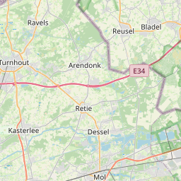
Distance Map Between Balen and Rotselaar
Balen, , Belgium ↔ Rotselaar, , Belgium = 25 miles = 40 km.


How far is it between Balen and Rotselaar
Balen is located in Belgium with (51.1684,5.1703) coordinates and Rotselaar is located in Belgium with (50.953,4.7167) coordinates. The calculated flying distance from Balen to Rotselaar is equal to 25 miles which is equal to 40 km.
If you want to go by car, the driving distance between Balen and Rotselaar is 61.07 km. If you ride your car with an average speed of 112 kilometers/hour (70 miles/h), travel time will be 00 hours 32 minutes. Please check the avg. speed travel time table on the right for various options.
Difference between fly and go by a car is 21 km.
| City/Place | Latitude and Longitude | GPS Coordinates |
|---|---|---|
| Balen | 51.1684, 5.1703 | 51° 10´ 6.1320'' N 5° 10´ 12.9720'' E |
| Rotselaar | 50.953, 4.7167 | 50° 57´ 10.8720'' N 4° 42´ 59.9400'' E |
Estimated Travel Time Between Balen and Rotselaar
| Average Speed | Travel Time |
|---|---|
| 30 mph (48 km/h) | 01 hours 16 minutes |
| 40 mph (64 km/h) | 00 hours 57 minutes |
| 50 mph (80 km/h) | 00 hours 45 minutes |
| 60 mph (97 km/h) | 00 hours 37 minutes |
| 70 mph (112 km/h) | 00 hours 32 minutes |
| 75 mph (120 km/h) | 00 hours 30 minutes |
Related Distances from Balen
| Cities | Distance |
|---|---|
| Balen to Tongeren | 60 km |
| Balen to Mol | 6 km |
| Balen to Maasmechelen | 62 km |
| Balen to Lede | 125 km |
| Balen to Geel | 14 km |
Related Distances to Rotselaar
| Cities | Distance |
|---|---|
| Leuven to Rotselaar | 12 km |
| Roeselare to Rotselaar | 160 km |
| Balen to Rotselaar | 61 km |
| Brugge to Rotselaar | 134 km |
| Herentals to Rotselaar | 35 km |