Distance from Balotra to Kaman
Distance between Balotra and Kaman is 539 kilometers (335 miles).
Driving distance from Balotra to Kaman is 660 kilometers (410 miles).
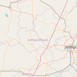
Distance Map Between Balotra and Kaman
Balotra, Jaipur, India ↔ Kaman, Jaipur, India = 335 miles = 539 km.


How far is it between Bālotra and Kāman
Balotra is located in India with (25.8324,72.24) coordinates and Kaman is located in India with (27.6579,77.2691) coordinates. The calculated flying distance from Balotra to Kaman is equal to 335 miles which is equal to 539 km.
If you want to go by car, the driving distance between Balotra and Kaman is 660 km. If you ride your car with an average speed of 112 kilometers/hour (70 miles/h), travel time will be 05 hours 53 minutes. Please check the avg. speed travel time table on the right for various options.
Difference between fly and go by a car is 121 km.
| City/Place | Latitude and Longitude | GPS Coordinates |
|---|---|---|
| Balotra | 25.8324, 72.24 | 25° 49´ 56.7120'' N 72° 14´ 24.0000'' E |
| Kaman | 27.6579, 77.2691 | 27° 39´ 28.4760'' N 77° 16´ 8.6880'' E |
Estimated Travel Time Between Bālotra and Kāman
| Average Speed | Travel Time |
|---|---|
| 30 mph (48 km/h) | 13 hours 45 minutes |
| 40 mph (64 km/h) | 10 hours 18 minutes |
| 50 mph (80 km/h) | 08 hours 15 minutes |
| 60 mph (97 km/h) | 06 hours 48 minutes |
| 70 mph (112 km/h) | 05 hours 53 minutes |
| 75 mph (120 km/h) | 05 hours 30 minutes |
Related Distances from Balotra
| Cities | Distance |
|---|---|
| Balotra to Siwana | 35 km |
| Balotra to Jodhpur | 104 km |
| Balotra to Barmer | 104 km |
| Balotra to Bhinmal | 137 km |
| Balotra to Pali | 143 km |
Related Distances to Kaman
| Cities | Distance |
|---|---|
| Bharatpur to Kaman | 58 km |
| Alwar to Kaman | 81 km |
| Bayana to Kaman | 98 km |
| Bhiwadi to Kaman | 101 km |
| Dhaulpur to Kaman | 145 km |