Distance from Bamako to Divo
Distance between Bamako and Divo is 811 kilometers (504 miles).
Driving distance from Bamako to Divo is 974 kilometers (605 miles).
Distance Map Between Bamako and Divo
Bamako, Mali ↔ Divo, Ivory Coast = 504 miles = 811 km.


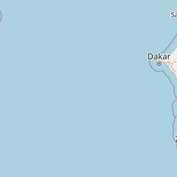


Leaflet | © OpenStreetMap
How far is it between Bamako and Divo
Bamako is located in Mali with (12.65,-8) coordinates and Divo is located in Ivory Coast with (5.8374,-5.3572) coordinates. The calculated flying distance from Bamako to Divo is equal to 504 miles which is equal to 811 km.
If you want to go by car, the driving distance between Bamako and Divo is 973.88 km. If you ride your car with an average speed of 112 kilometers/hour (70 miles/h), travel time will be 08 hours 41 minutes. Please check the avg. speed travel time table on the right for various options.
Difference between fly and go by a car is 163 km.
| City/Place | Latitude and Longitude | GPS Coordinates |
|---|---|---|
| Bamako | 12.65, -8 | 12° 39´ 0.0000'' N 8° 0´ 0.0000'' W |
| Divo | 5.8374, -5.3572 | 5° 50´ 14.6040'' N 5° 21´ 26.0280'' W |
Estimated Travel Time Between Bamako and Divo
| Average Speed | Travel Time |
|---|---|
| 30 mph (48 km/h) | 20 hours 17 minutes |
| 40 mph (64 km/h) | 15 hours 13 minutes |
| 50 mph (80 km/h) | 12 hours 10 minutes |
| 60 mph (97 km/h) | 10 hours 02 minutes |
| 70 mph (112 km/h) | 08 hours 41 minutes |
| 75 mph (120 km/h) | 08 hours 06 minutes |
Bamako, Mali
Related Distances from Bamako
| Cities | Distance |
|---|---|
| Bamako to Abidjan | 1108 km |
| Bamako to Korhogo | 597 km |
| Bamako to San Pedro 2 | 1021 km |
| Bamako to Tengrela | 363 km |
| Bamako to Bouake | 753 km |