Distance from Bangor to Berlin
Distance between Bangor and Berlin is 1277 kilometers (794 miles).
Driving distance from Bangor to Berlin is 1888 kilometers (1173 miles).
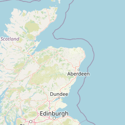
Distance Map Between Bangor and Berlin
Bangor, Belfast, United Kingdom ↔ Berlin, Germany = 794 miles = 1277 km.


How far is it between Bangor and Berlin
Bangor is located in United Kingdom with (54.6534,-5.669) coordinates and Berlin is located in Germany with (52.5244,13.4105) coordinates. The calculated flying distance from Bangor to Berlin is equal to 794 miles which is equal to 1277 km.
If you want to go by car, the driving distance between Bangor and Berlin is 1887.94 km. If you ride your car with an average speed of 112 kilometers/hour (70 miles/h), travel time will be 16 hours 51 minutes. Please check the avg. speed travel time table on the right for various options.
Difference between fly and go by a car is 611 km.
| City/Place | Latitude and Longitude | GPS Coordinates |
|---|---|---|
| Bangor | 54.6534, -5.669 | 54° 39´ 12.1680'' N 5° 40´ 8.2200'' W |
| Berlin | 52.5244, 13.4105 | 52° 31´ 27.7320'' N 13° 24´ 37.9080'' E |
Estimated Travel Time Between Bangor and Berlin
| Average Speed | Travel Time |
|---|---|
| 30 mph (48 km/h) | 39 hours 19 minutes |
| 40 mph (64 km/h) | 29 hours 29 minutes |
| 50 mph (80 km/h) | 23 hours 35 minutes |
| 60 mph (97 km/h) | 19 hours 27 minutes |
| 70 mph (112 km/h) | 16 hours 51 minutes |
| 75 mph (120 km/h) | 15 hours 43 minutes |
Related Distances from Bangor
| Cities | Distance |
|---|---|
| Bangor to Berlin | 1888 km |
| Bangor to Munich | 1928 km |
| Bangor to Frankfurt Am Main | 1558 km |
| Bangor to Hamburg | 1718 km |
| Bangor to Koeln | 1370 km |
Related Distances to Berlin
| Cities | Distance |
|---|---|
| London to Berlin | 1093 km |
| Manchester to Berlin | 1444 km |
| City Of London to Berlin | 1110 km |
| Edinburgh to Berlin | 1729 km |
| Birmingham to Berlin | 1315 km |