Distance from Bangor to Madrid
Distance between Bangor and Madrid is 1590 kilometers (988 miles).
Driving distance from Bangor to Madrid is 2510 kilometers (1560 miles).
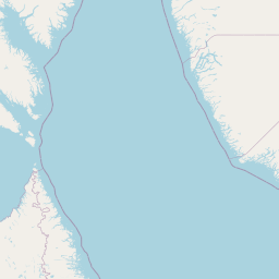
Distance Map Between Bangor and Madrid
Bangor, Belfast, United Kingdom ↔ Madrid, Spain = 988 miles = 1590 km.


How far is it between Bangor and Madrid
Bangor is located in United Kingdom with (54.6534,-5.669) coordinates and Madrid is located in Spain with (40.4165,-3.7026) coordinates. The calculated flying distance from Bangor to Madrid is equal to 988 miles which is equal to 1590 km.
If you want to go by car, the driving distance between Bangor and Madrid is 2510.24 km. If you ride your car with an average speed of 112 kilometers/hour (70 miles/h), travel time will be 22 hours 24 minutes. Please check the avg. speed travel time table on the right for various options.
Difference between fly and go by a car is 920 km.
| City/Place | Latitude and Longitude | GPS Coordinates |
|---|---|---|
| Bangor | 54.6534, -5.669 | 54° 39´ 12.1680'' N 5° 40´ 8.2200'' W |
| Madrid | 40.4165, -3.7026 | 40° 24´ 59.4000'' N 3° 42´ 9.2160'' W |
Estimated Travel Time Between Bangor and Madrid
| Average Speed | Travel Time |
|---|---|
| 30 mph (48 km/h) | 52 hours 17 minutes |
| 40 mph (64 km/h) | 39 hours 13 minutes |
| 50 mph (80 km/h) | 31 hours 22 minutes |
| 60 mph (97 km/h) | 25 hours 52 minutes |
| 70 mph (112 km/h) | 22 hours 24 minutes |
| 75 mph (120 km/h) | 20 hours 55 minutes |
Related Distances from Bangor
| Cities | Distance |
|---|---|
| Bangor to Madrid | 2510 km |
| Bangor to Barcelona | 2281 km |
| Bangor to Zaragoza | 2296 km |
Related Distances to Madrid
| Cities | Distance |
|---|---|
| London to Madrid | 1719 km |
| Manchester to Madrid | 2081 km |
| Liverpool to Madrid | 2086 km |
| Birmingham to Madrid | 1937 km |
| Bristol to Madrid | 1917 km |