Distance from Baotou to Wuhai
Distance between Baotou and Wuhai is 277 kilometers (172 miles).
Driving distance from Baotou to Wuhai is 390 kilometers (242 miles).
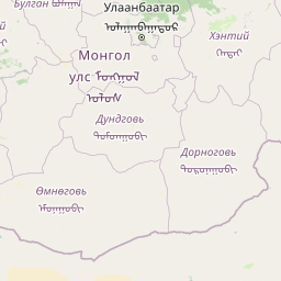
Distance Map Between Baotou and Wuhai
Baotou, Hohhot, China ↔ Wuhai, Hohhot, China = 172 miles = 277 km.


How far is it between Baotou and Wuhai
Baotou is located in China with (40.6522,109.8222) coordinates and Wuhai is located in China with (39.6844,106.8158) coordinates. The calculated flying distance from Baotou to Wuhai is equal to 172 miles which is equal to 277 km.
If you want to go by car, the driving distance between Baotou and Wuhai is 389.77 km. If you ride your car with an average speed of 112 kilometers/hour (70 miles/h), travel time will be 03 hours 28 minutes. Please check the avg. speed travel time table on the right for various options.
Difference between fly and go by a car is 113 km.
| City/Place | Latitude and Longitude | GPS Coordinates |
|---|---|---|
| Baotou | 40.6522, 109.8222 | 40° 39´ 7.9920'' N 109° 49´ 19.9920'' E |
| Wuhai | 39.6844, 106.8158 | 39° 41´ 3.9120'' N 106° 48´ 56.9880'' E |
Estimated Travel Time Between Baotou and Wuhai
| Average Speed | Travel Time |
|---|---|
| 30 mph (48 km/h) | 08 hours 07 minutes |
| 40 mph (64 km/h) | 06 hours 05 minutes |
| 50 mph (80 km/h) | 04 hours 52 minutes |
| 60 mph (97 km/h) | 04 hours 01 minutes |
| 70 mph (112 km/h) | 03 hours 28 minutes |
| 75 mph (120 km/h) | 03 hours 14 minutes |
Related Distances from Baotou
| Cities | Distance |
|---|---|
| Baotou to Shiguai | 51 km |
| Baotou to Ulanhot | 1464 km |
| Baotou to Manzhouli | 2658 km |
| Baotou to Dongsheng | 108 km |
| Baotou to Tongliao | 1365 km |
Related Distances to Wuhai
| Cities | Distance |
|---|---|
| Chifeng to Wuhai | 1400 km |
| Ordos to Wuhai | 342 km |
| Jagdaqi to Wuhai | 2789 km |
| Jining 2 to Wuhai | 690 km |
| Baotou to Wuhai | 390 km |