Distance from Baranoa to Repelon
Distance between Baranoa and Repelon is 41 kilometers (25 miles).
Driving distance from Baranoa to Repelon is 56 kilometers (35 miles).
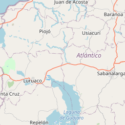
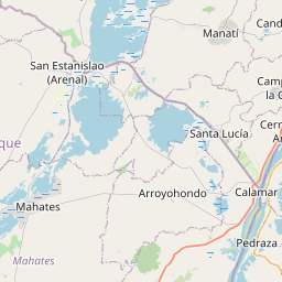
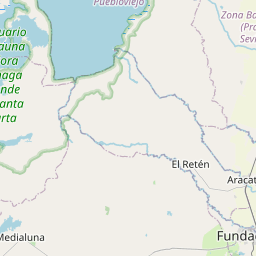
Distance Map Between Baranoa and Repelon
Baranoa, Barranquilla, Colombia ↔ Repelon, Barranquilla, Colombia = 25 miles = 41 km.


How far is it between Baranoa and Repelón
Baranoa is located in Colombia with (10.7941,-74.9164) coordinates and Repelon is located in Colombia with (10.4919,-75.1292) coordinates. The calculated flying distance from Baranoa to Repelon is equal to 25 miles which is equal to 41 km.
If you want to go by car, the driving distance between Baranoa and Repelon is 56.18 km. If you ride your car with an average speed of 112 kilometers/hour (70 miles/h), travel time will be 00 hours 30 minutes. Please check the avg. speed travel time table on the right for various options.
Difference between fly and go by a car is 15 km.
| City/Place | Latitude and Longitude | GPS Coordinates |
|---|---|---|
| Baranoa | 10.7941, -74.9164 | 10° 47´ 38.6880'' N 74° 54´ 59.0400'' W |
| Repelon | 10.4919, -75.1292 | 10° 29´ 30.9840'' N 75° 7´ 45.0120'' W |
Estimated Travel Time Between Baranoa and Repelón
| Average Speed | Travel Time |
|---|---|
| 30 mph (48 km/h) | 01 hours 10 minutes |
| 40 mph (64 km/h) | 00 hours 52 minutes |
| 50 mph (80 km/h) | 00 hours 42 minutes |
| 60 mph (97 km/h) | 00 hours 34 minutes |
| 70 mph (112 km/h) | 00 hours 30 minutes |
| 75 mph (120 km/h) | 00 hours 28 minutes |
Related Distances from Baranoa
| Cities | Distance |
|---|---|
| Baranoa to Sabanagrande | 24 km |
| Baranoa to Sabanalarga | 22 km |
| Baranoa to Puerto Colombia | 49 km |
| Baranoa to Santa Lucia 4 | 83 km |
| Baranoa to Campo De La Cruz | 60 km |
Related Distances to Repelon
| Cities | Distance |
|---|---|
| Galapa to Repelon | 69 km |
| Puerto Colombia to Repelon | 107 km |
| Campo De La Cruz to Repelon | 58 km |
| Baranoa to Repelon | 56 km |
| Palmar De Varela to Repelon | 70 km |