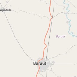
Distance from Baraut to Kandhla
Distance between Baraut and Kandhla is 24 kilometers (15 miles).
Driving distance from Baraut to Kandhla is 26 kilometers (16 miles).
Distance Map Between Baraut and Kandhla
Baraut, Lucknow, India ↔ Kandhla, Lucknow, India = 15 miles = 24 km.


How far is it between Baraut and Kāndhla
Baraut is located in India with (29.1017,77.2624) coordinates and Kandhla is located in India with (29.321,77.2699) coordinates. The calculated flying distance from Baraut to Kandhla is equal to 15 miles which is equal to 24 km.
If you want to go by car, the driving distance between Baraut and Kandhla is 26.41 km. If you ride your car with an average speed of 112 kilometers/hour (70 miles/h), travel time will be 00 hours 14 minutes. Please check the avg. speed travel time table on the right for various options.
Difference between fly and go by a car is 2 km.
| City/Place | Latitude and Longitude | GPS Coordinates |
|---|---|---|
| Baraut | 29.1017, 77.2624 | 29° 6´ 6.0120'' N 77° 15´ 44.7120'' E |
| Kandhla | 29.321, 77.2699 | 29° 19´ 15.6720'' N 77° 16´ 11.6040'' E |
Estimated Travel Time Between Baraut and Kāndhla
| Average Speed | Travel Time |
|---|---|
| 30 mph (48 km/h) | 00 hours 33 minutes |
| 40 mph (64 km/h) | 00 hours 24 minutes |
| 50 mph (80 km/h) | 00 hours 19 minutes |
| 60 mph (97 km/h) | 00 hours 16 minutes |
| 70 mph (112 km/h) | 00 hours 14 minutes |
| 75 mph (120 km/h) | 00 hours 13 minutes |
Related Distances from Baraut
| Cities | Distance |
|---|---|
| Baraut to Budhana | 32 km |
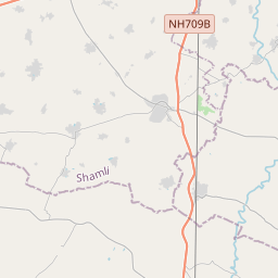
| Baraut to Shamli | 42 km |
| Baraut to Loni | 42 km |
| Baraut to Muzaffarnagar | 64 km |
| Baraut to Khatauli | 57 km |
Related Distances to Kandhla
| Cities | Distance |
|---|---|
| Kairana to Kandhla | 11 km |
| Baraut to Kandhla | 26 km |
| Deoband to Kandhla | 77 km |
| Ghaziabad to Kandhla | 105 km |
| Gangoh to Kandhla | 60 km |