Distance from Basingstoke to Cambridge
Distance between Basingstoke and Cambridge is 133 kilometers (83 miles).
Driving distance from Basingstoke to Cambridge is 162 kilometers (101 miles).
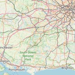
Distance Map Between Basingstoke and Cambridge
Basingstoke, London, United Kingdom ↔ Cambridge, London, United Kingdom = 83 miles = 133 km.


How far is it between Basingstoke and Cambridge
Basingstoke is located in United Kingdom with (51.2625,-1.0871) coordinates and Cambridge is located in United Kingdom with (52.2,0.1167) coordinates. The calculated flying distance from Basingstoke to Cambridge is equal to 83 miles which is equal to 133 km.
If you want to go by car, the driving distance between Basingstoke and Cambridge is 162.43 km. If you ride your car with an average speed of 112 kilometers/hour (70 miles/h), travel time will be 01 hours 27 minutes. Please check the avg. speed travel time table on the right for various options.
Difference between fly and go by a car is 29 km.
| City/Place | Latitude and Longitude | GPS Coordinates |
|---|---|---|
| Basingstoke | 51.2625, -1.0871 | 51° 15´ 44.9640'' N 1° 5´ 13.4880'' W |
| Cambridge | 52.2, 0.1167 | 52° 12´ 0.0000'' N 0° 7´ 0.0120'' E |
Estimated Travel Time Between Basingstoke and Cambridge
| Average Speed | Travel Time |
|---|---|
| 30 mph (48 km/h) | 03 hours 23 minutes |
| 40 mph (64 km/h) | 02 hours 32 minutes |
| 50 mph (80 km/h) | 02 hours 01 minutes |
| 60 mph (97 km/h) | 01 hours 40 minutes |
| 70 mph (112 km/h) | 01 hours 27 minutes |
| 75 mph (120 km/h) | 01 hours 21 minutes |
Related Distances from Basingstoke
| Cities | Distance |
|---|---|
| Basingstoke to Reading | 30 km |
| Basingstoke to Southampton | 49 km |
| Basingstoke to City Of London | 86 km |
| Basingstoke to Oxford | 70 km |
| Basingstoke to Guildford | 50 km |
Related Distances to Cambridge
| Cities | Distance |
|---|---|
| London to Cambridge | 102 km |
| Oxford to Cambridge | 133 km |
| Birmingham to Cambridge | 163 km |
| Bedford to Cambridge | 50 km |
| Brighton to Cambridge | 193 km |