Distance from Batley to Hamburg
Distance between Batley and Hamburg is 767 kilometers (477 miles).
Driving distance from Batley to Hamburg is 1231 kilometers (765 miles).
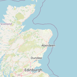
Distance Map Between Batley and Hamburg
Batley, London, United Kingdom ↔ Hamburg, Germany = 477 miles = 767 km.


How far is it between Batley and Hamburg
Batley is located in United Kingdom with (53.7029,-1.6337) coordinates and Hamburg is located in Germany with (53.5753,10.0153) coordinates. The calculated flying distance from Batley to Hamburg is equal to 477 miles which is equal to 767 km.
If you want to go by car, the driving distance between Batley and Hamburg is 1231.13 km. If you ride your car with an average speed of 112 kilometers/hour (70 miles/h), travel time will be 10 hours 59 minutes. Please check the avg. speed travel time table on the right for various options.
Difference between fly and go by a car is 464 km.
| City/Place | Latitude and Longitude | GPS Coordinates |
|---|---|---|
| Batley | 53.7029, -1.6337 | 53° 42´ 10.4760'' N 1° 38´ 1.3200'' W |
| Hamburg | 53.5753, 10.0153 | 53° 34´ 31.1520'' N 10° 0´ 55.2240'' E |
Estimated Travel Time Between Batley and Hamburg
| Average Speed | Travel Time |
|---|---|
| 30 mph (48 km/h) | 25 hours 38 minutes |
| 40 mph (64 km/h) | 19 hours 14 minutes |
| 50 mph (80 km/h) | 15 hours 23 minutes |
| 60 mph (97 km/h) | 12 hours 41 minutes |
| 70 mph (112 km/h) | 10 hours 59 minutes |
| 75 mph (120 km/h) | 10 hours 15 minutes |
Related Distances from Batley
| Cities | Distance |
|---|---|
| Batley to Berlin | 1401 km |
| Batley to Munich | 1441 km |
| Batley to Hamburg | 1231 km |
| Batley to Koeln | 895 km |
Related Distances to Hamburg
| Cities | Distance |
|---|---|
| London to Hamburg | 923 km |
| Liverpool to Hamburg | 1299 km |
| Manchester to Hamburg | 1274 km |
| Birmingham to Hamburg | 1145 km |
| Edinburgh to Hamburg | 1572 km |