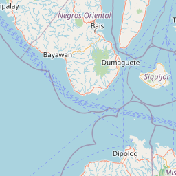
Distance from Bayawan to Cogan
Distance between Bayawan and Cogan is 191 kilometers (118 miles).
Driving distance from Bayawan to Cogan is 260 kilometers (161 miles).
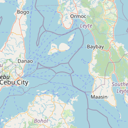
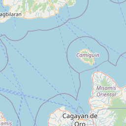
Distance Map Between Bayawan and Cogan
Bayawan, Cebu City, Philippines ↔ Cogan, Cebu City, Philippines = 118 miles = 191 km.


How far is it between Bayawan and Cogan
Bayawan is located in Philippines with (9.3649,122.804) coordinates and Cogan is located in Philippines with (10.5931,124.0178) coordinates. The calculated flying distance from Bayawan to Cogan is equal to 118 miles which is equal to 191 km.
If you want to go by car, the driving distance between Bayawan and Cogan is 259.52 km. If you ride your car with an average speed of 112 kilometers/hour (70 miles/h), travel time will be 02 hours 19 minutes. Please check the avg. speed travel time table on the right for various options.
Difference between fly and go by a car is 69 km.
| City/Place | Latitude and Longitude | GPS Coordinates |
|---|---|---|
| Bayawan | 9.3649, 122.804 | 9° 21´ 53.6400'' N 122° 48´ 14.4000'' E |
| Cogan | 10.5931, 124.0178 | 10° 35´ 35.0160'' N 124° 1´ 4.0080'' E |
Estimated Travel Time Between Bayawan and Cogan
| Average Speed | Travel Time |
|---|---|
| 30 mph (48 km/h) | 05 hours 24 minutes |
| 40 mph (64 km/h) | 04 hours 03 minutes |
| 50 mph (80 km/h) | 03 hours 14 minutes |
| 60 mph (97 km/h) | 02 hours 40 minutes |
| 70 mph (112 km/h) | 02 hours 19 minutes |
| 75 mph (120 km/h) | 02 hours 09 minutes |
Related Distances from Bayawan
| Cities | Distance |
|---|---|
| Bayawan to Dumaguete | 90 km |
| Bayawan to Santa Catalina | 8 km |
| Bayawan to Tanjay | 58 km |
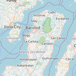
| Bayawan to Canlaon | 192 km |
| Bayawan to Guihulngan | 143 km |
Related Distances to Cogan
| Cities | Distance |
|---|---|
| Bayawan to Cogan | 260 km |
| Carcar to Cogan | 80 km |
| Canlaon to Cogan | 167 km |
| Bogo to Cogan | 59 km |
| Bantayan to Cogan | 98 km |