Distance from Bedi to Limbdi
Distance between Bedi and Limbdi is 182 kilometers (113 miles).
Driving distance from Bedi to Limbdi is 209 kilometers (130 miles).
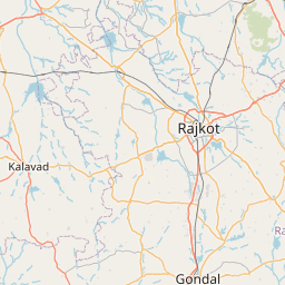
Distance Map Between Bedi and Limbdi
Bedi, Ghandinagar, India ↔ Limbdi, Ghandinagar, India = 113 miles = 182 km.


How far is it between Bedi and Limbdi
Bedi is located in India with (22.5014,70.0436) coordinates and Limbdi is located in India with (22.5651,71.8108) coordinates. The calculated flying distance from Bedi to Limbdi is equal to 113 miles which is equal to 182 km.
If you want to go by car, the driving distance between Bedi and Limbdi is 209.12 km. If you ride your car with an average speed of 112 kilometers/hour (70 miles/h), travel time will be 01 hours 52 minutes. Please check the avg. speed travel time table on the right for various options.
Difference between fly and go by a car is 27 km.
| City/Place | Latitude and Longitude | GPS Coordinates |
|---|---|---|
| Bedi | 22.5014, 70.0436 | 22° 30´ 5.1480'' N 70° 2´ 37.0680'' E |
| Limbdi | 22.5651, 71.8108 | 22° 33´ 54.2520'' N 71° 48´ 38.7360'' E |
Estimated Travel Time Between Bedi and Limbdi
| Average Speed | Travel Time |
|---|---|
| 30 mph (48 km/h) | 04 hours 21 minutes |
| 40 mph (64 km/h) | 03 hours 16 minutes |
| 50 mph (80 km/h) | 02 hours 36 minutes |
| 60 mph (97 km/h) | 02 hours 09 minutes |
| 70 mph (112 km/h) | 01 hours 52 minutes |
| 75 mph (120 km/h) | 01 hours 44 minutes |
Related Distances from Bedi
| Cities | Distance |
|---|---|
| Bedi to Jamnagar | 5 km |
| Bedi to Rajkot | 95 km |
| Bedi to Patan 2 | 362 km |
| Bedi to Khambhaliya | 61 km |
| Bedi to Salaya | 72 km |
Related Distances to Limbdi
| Cities | Distance |
|---|---|
| Chotila to Limbdi | 69 km |
| Dahod to Limbdi | 299 km |
| Anand to Limbdi | 139 km |
| Ahmedabad to Limbdi | 104 km |
| Godhra to Limbdi | 219 km |