Distance from Beersel to Diest
Distance between Beersel and Diest is 58 kilometers (36 miles).
Distance Map Between Beersel and Diest
Beersel, , Belgium ↔ Diest, , Belgium = 36 miles = 58 km.


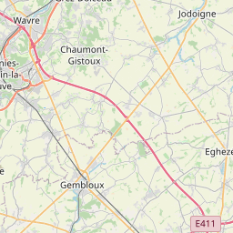


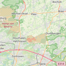

Leaflet | © OpenStreetMap
How far is it between Beersel and Diest
Beersel is located in Belgium with (50.7659,4.3002) coordinates and Diest is located in Belgium with (50.9892,5.0506) coordinates. The calculated flying distance from Beersel to Diest is equal to 36 miles which is equal to 58 km.
| City/Place | Latitude and Longitude | GPS Coordinates |
|---|---|---|
| Beersel | 50.7659, 4.3002 | 50° 45´ 57.2040'' N 4° 18´ 0.7200'' E |
| Diest | 50.9892, 5.0506 | 50° 59´ 21.2280'' N 5° 3´ 2.2320'' E |
Beersel, , Belgium
Related Distances from Beersel
| Cities | Distance |
|---|---|
| Beersel to Wetteren | 53 km |
| Beersel to Leuven | 53 km |
| Beersel to Zaventem | 33 km |
| Beersel to Overijse | 41 km |
| Beersel to Hamme | 63 km |
Diest, , Belgium
Related Distances to Diest
| Cities | Distance |
|---|---|
| Aalter to Diest | 134 km |
| Asse to Diest | 75 km |
| Antwerpen to Diest | 63 km |
| Aarschot to Diest | 17 km |
| Brugge to Diest | 157 km |