Distance from Beipiao to Xingcheng
Distance between Beipiao and Xingcheng is 131 kilometers (81 miles).
Driving distance from Beipiao to Xingcheng is 217 kilometers (135 miles).
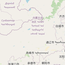
Distance Map Between Beipiao and Xingcheng
Beipiao, Shenyang, China ↔ Xingcheng, Shenyang, China = 81 miles = 131 km.


How far is it between Beipiao and Xingcheng
Beipiao is located in China with (41.7919,120.7792) coordinates and Xingcheng is located in China with (40.6167,120.7167) coordinates. The calculated flying distance from Beipiao to Xingcheng is equal to 81 miles which is equal to 131 km.
If you want to go by car, the driving distance between Beipiao and Xingcheng is 216.91 km. If you ride your car with an average speed of 112 kilometers/hour (70 miles/h), travel time will be 01 hours 56 minutes. Please check the avg. speed travel time table on the right for various options.
Difference between fly and go by a car is 86 km.
| City/Place | Latitude and Longitude | GPS Coordinates |
|---|---|---|
| Beipiao | 41.7919, 120.7792 | 41° 47´ 30.9840'' N 120° 46´ 45.0120'' E |
| Xingcheng | 40.6167, 120.7167 | 40° 37´ 0.0120'' N 120° 43´ 0.0120'' E |
Estimated Travel Time Between Beipiao and Xingcheng
| Average Speed | Travel Time |
|---|---|
| 30 mph (48 km/h) | 04 hours 31 minutes |
| 40 mph (64 km/h) | 03 hours 23 minutes |
| 50 mph (80 km/h) | 02 hours 42 minutes |
| 60 mph (97 km/h) | 02 hours 14 minutes |
| 70 mph (112 km/h) | 01 hours 56 minutes |
| 75 mph (120 km/h) | 01 hours 48 minutes |
Related Distances from Beipiao
| Cities | Distance |
|---|---|
| Beipiao to Xinmin | 232 km |
| Beipiao to Fushun | 325 km |
| Beipiao to Langtou | 509 km |
| Beipiao to Benxi | 373 km |
| Beipiao to Lingyuan | 149 km |
Related Distances to Xingcheng
| Cities | Distance |
|---|---|
| Panshan to Xingcheng | 154 km |
| Jinzhou to Xingcheng | 75 km |
| Huanren to Xingcheng | 502 km |
| Dandong to Xingcheng | 449 km |
| Hushitai to Xingcheng | 299 km |