Distance from Bela to Zhob
Distance between Bela and Zhob is 645 kilometers (401 miles).
Driving distance from Bela to Zhob is 843 kilometers (524 miles).
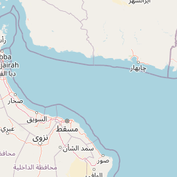
Distance Map Between Bela and Zhob
Bela, Quetta, Pakistan ↔ Zhob, Quetta, Pakistan = 401 miles = 645 km.


How far is it between Bela and Zhob
Bela is located in Pakistan with (26.2271,66.3111) coordinates and Zhob is located in Pakistan with (31.3411,69.4481) coordinates. The calculated flying distance from Bela to Zhob is equal to 401 miles which is equal to 645 km.
If you want to go by car, the driving distance between Bela and Zhob is 842.69 km. If you ride your car with an average speed of 112 kilometers/hour (70 miles/h), travel time will be 07 hours 31 minutes. Please check the avg. speed travel time table on the right for various options.
Difference between fly and go by a car is 198 km.
| City/Place | Latitude and Longitude | GPS Coordinates |
|---|---|---|
| Bela | 26.2271, 66.3111 | 26° 13´ 37.5600'' N 66° 18´ 39.9600'' E |
| Zhob | 31.3411, 69.4481 | 31° 20´ 27.9960'' N 69° 26´ 53.0160'' E |
Estimated Travel Time Between Bela and Zhob
| Average Speed | Travel Time |
|---|---|
| 30 mph (48 km/h) | 17 hours 33 minutes |
| 40 mph (64 km/h) | 13 hours 10 minutes |
| 50 mph (80 km/h) | 10 hours 32 minutes |
| 60 mph (97 km/h) | 08 hours 41 minutes |
| 70 mph (112 km/h) | 07 hours 31 minutes |
| 75 mph (120 km/h) | 07 hours 01 minutes |
Related Distances from Bela
| Cities | Distance |
|---|---|
| Bela 2 to Uthal | 60 km |
| Bela 2 to Turbat | 560 km |
| Bela 2 to Gwadar | 595 km |
| Bela 2 to Sibi | 623 km |
| Bela 2 to Hala | 387 km |
Related Distances to Zhob
| Cities | Distance |
|---|---|
| Loralai to Zhob | 218 km |
| Gwadar to Zhob | 1429 km |
| Chaman to Zhob | 378 km |
| Pishin to Zhob | 293 km |
| Sibi to Zhob | 497 km |